

Yellowstone, Wyoming, Colorado
Yellowstone, Wyoming, Colorado
Concluding our Seattle to Denver Ride: Sagebrush, Pronghorns and the Rocky Mountains - June/July 2023
PART I
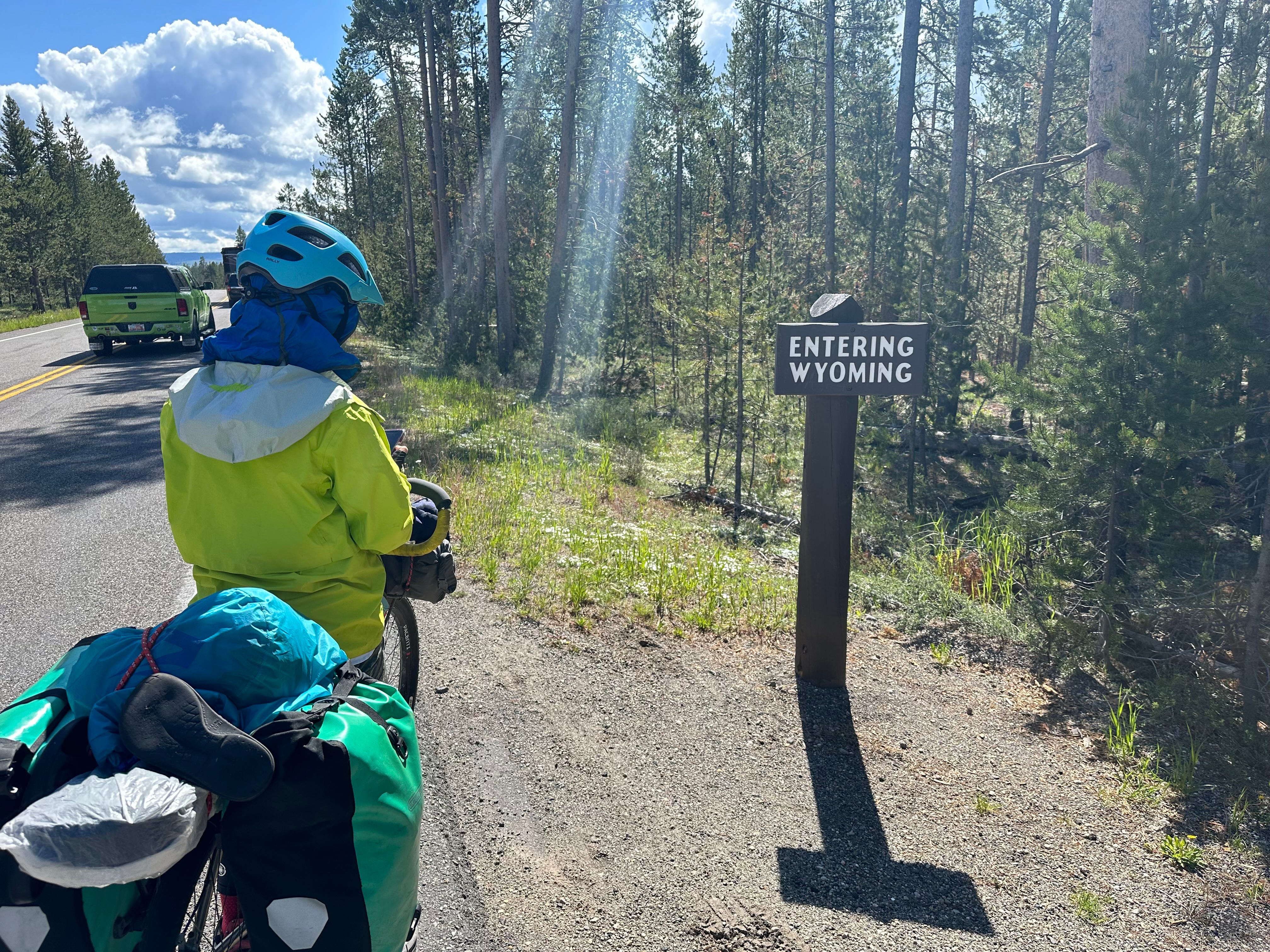
Yellowstone National Park
We feel about as far as one can possibly get from the Mexican deserts we had been biking earlier in the year; Yellowstone in late-spring is beginning to sprout green, rain once again becomes an issue, and large mammals are easily observed. A love-hate relationship is established with our actual biking through the huge park as we head south, towards the Grand Tetons.
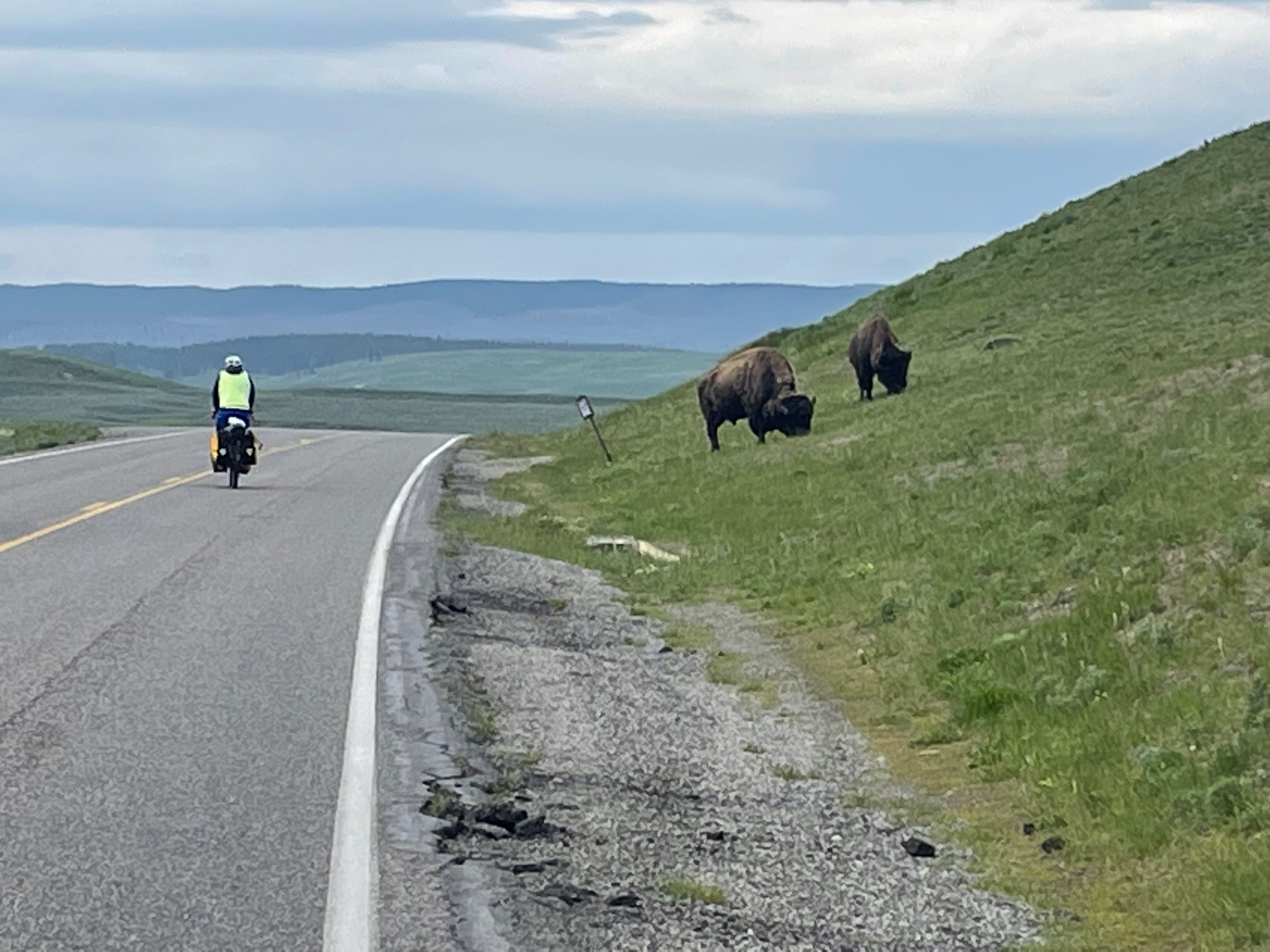
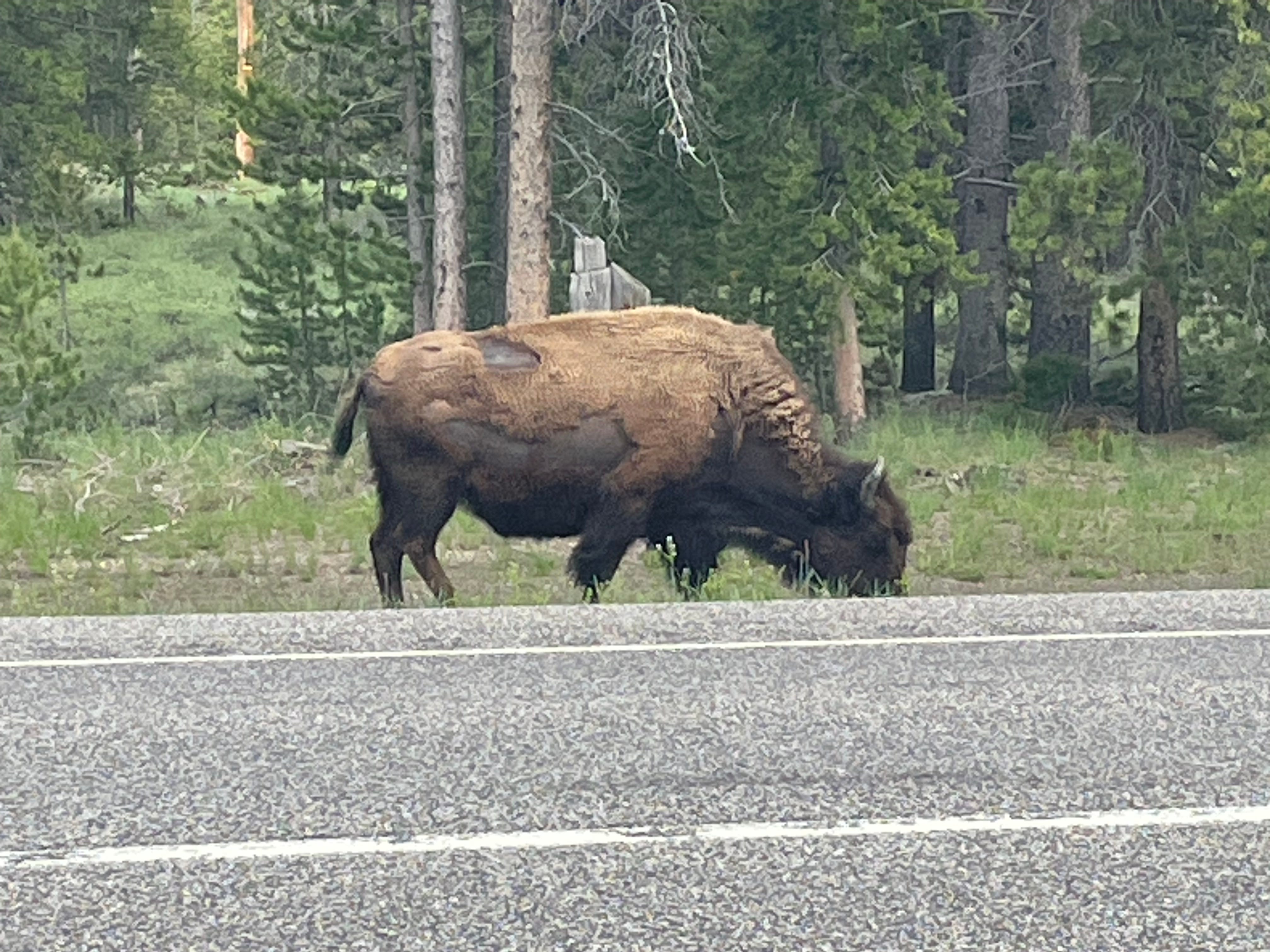
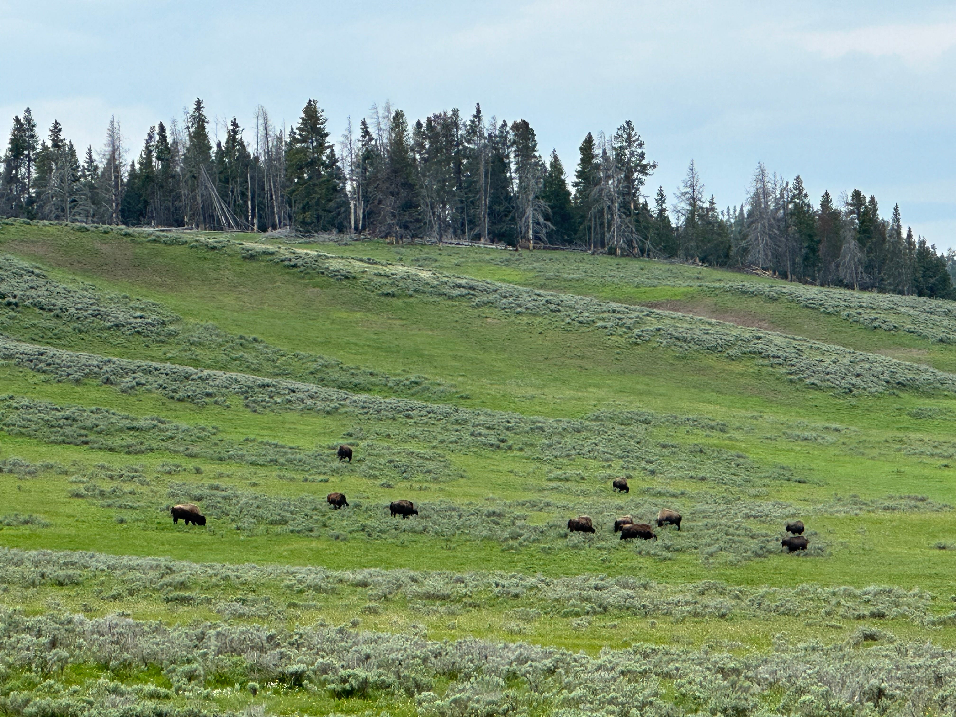
Transportation within Yellowstone is very auto-centric, and accommodations for the bicycle are clearly an afterthought. Cars were first allowed into the park in 1915, and a frenzy of road-building took place between 1926 and 1939. About 155 miles of road was built-out during that period. Today, Yellowstone has over 370 miles of accessible, paved roads. One could forgive the original planners for doing without bike lanes, but 100 years out, less so. The roads are narrow, busy, and pretty unforgiving when it comes to bikes. In addition, it is well-known, and we can confirm, that drivers in Yellowstone are looking to pull-over at any moment to stare at a bison or bear, perhaps even to feed a bear with a honey-covered cookie. A saving grace for us is that it is still off-season - in other words, it could have been worse had we waited until mid-summer to visit.
We determine that to survive the auto-onslaught, biking must be done early in the day, before traffic reaches a mid-day peak. I imagine the animals in the park must also make such calculations. The roads are for the most part in excellent condition, even in remote areas, encouraging the entry of even more cars.
Yellowstone ranks fourth among all National Parks in terms of number of visitors each year (over 4 million), behind Zion, Grand Canyon, and Great Smoky Mountain, and eighth in terms of size (2.2 million acres). Like most National Parks, one need only get off the main thorough-fares to find relative solitude. This is possible on a bike, although bikes in Yellowstone are pretty much restricted to roads, as opposed to back-country trail riding (not allowed).
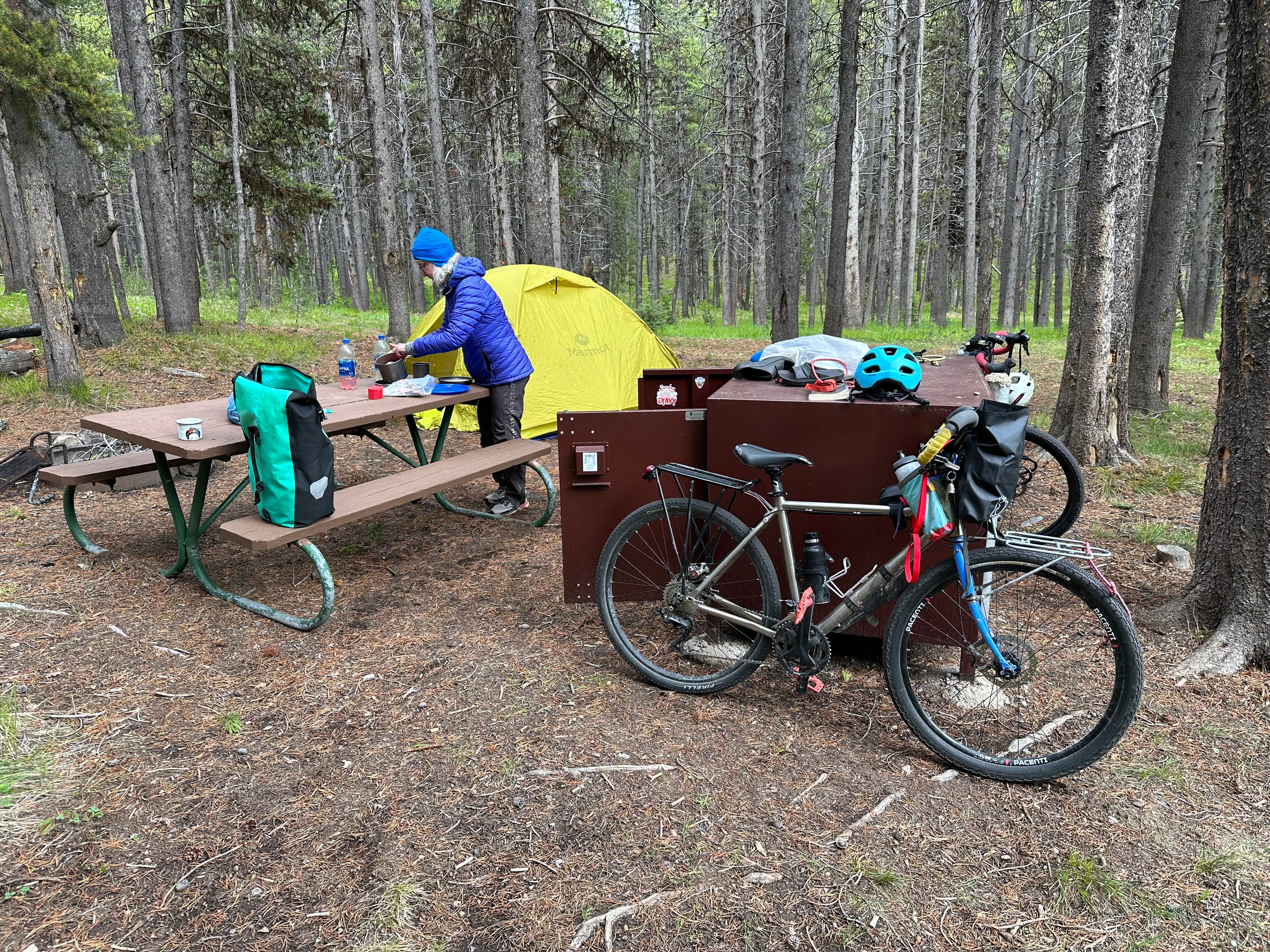
Perhaps due to both the time of year and the weather, we are able to find camping without a reservation. The campsite below was reserved exclusively for bicyclists-only, a nice touch.
By chance, we camp one rainy night next to a 62 year-old German woman - Hilga - who was racing the Trans-Am - the bike race across America from Astoria, Oregon to Yorktown, VA. It has been difficult for her, but she is determined to carry-on. Although way back in the standings, her real goal is to “simply” finish the race - no simple matter. We obtain her race name, and so become able to track her progress across the country via GPS signal (each racer carries a GPS tag). She is quite surprised at how kind and helpful virtually every American she has met has been - an experience at variance with the perception in Germany (according to Hilga) that all Americans are lazy and rude, with Big Macs protruding from their mouths.
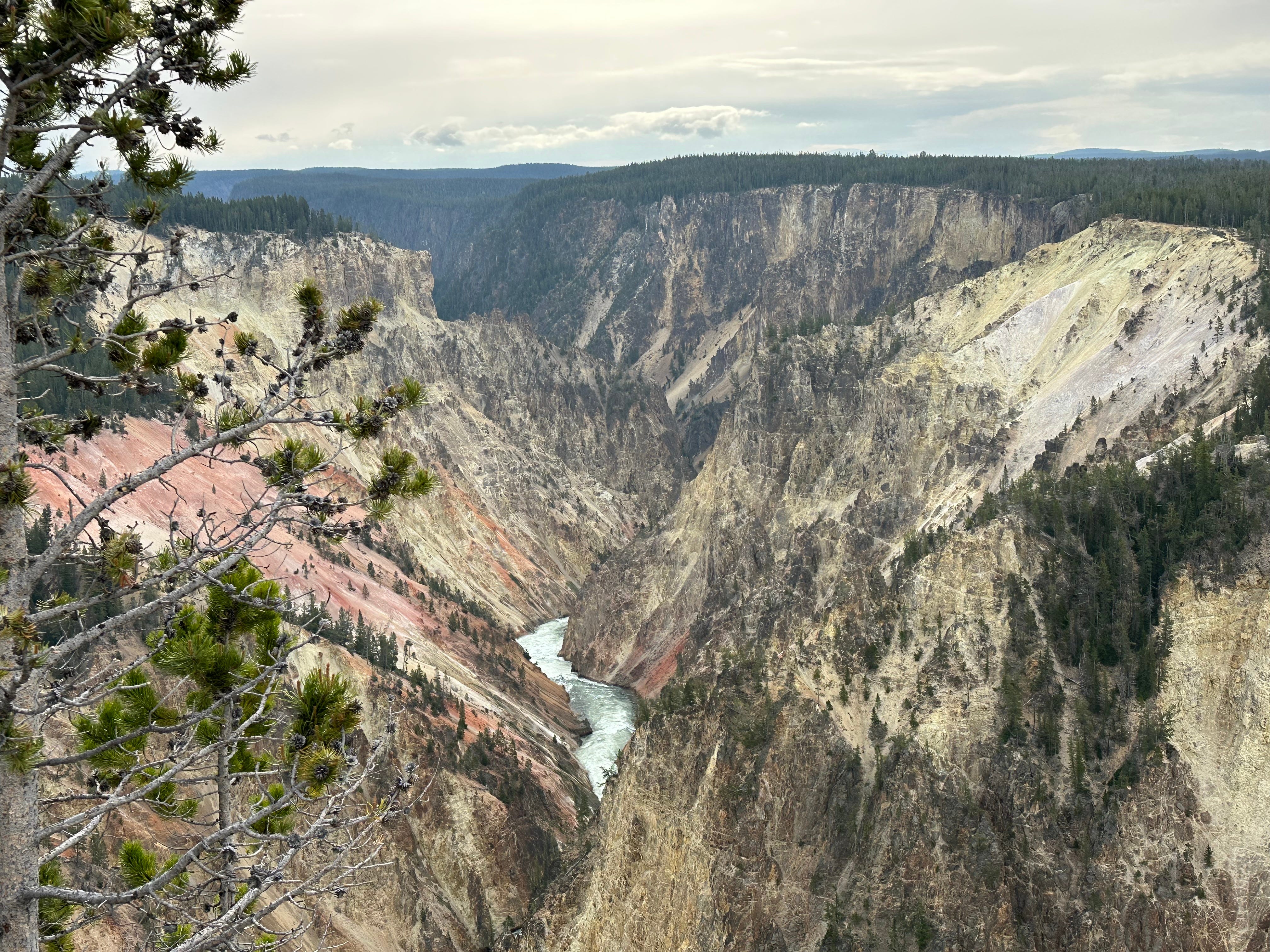
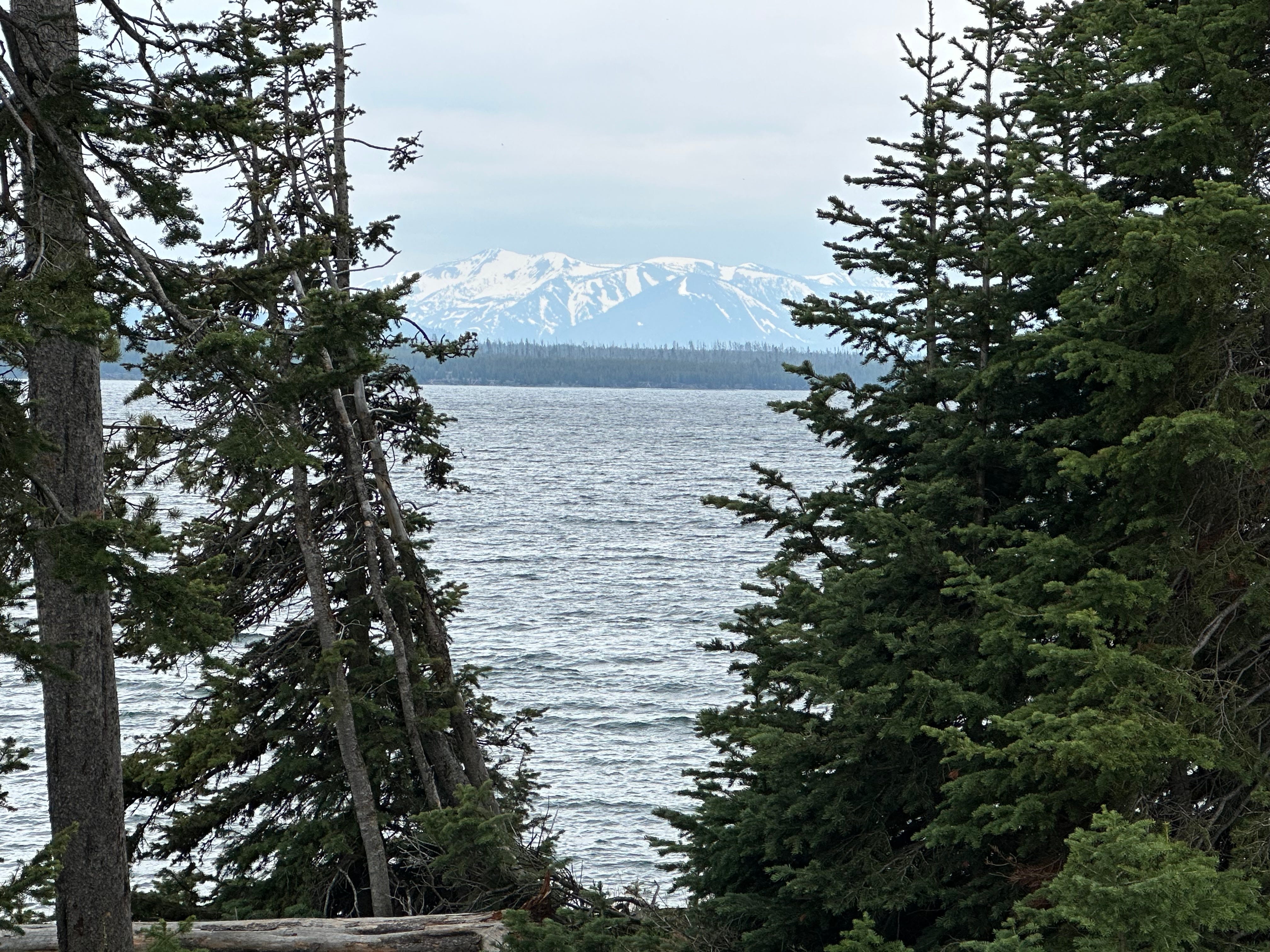
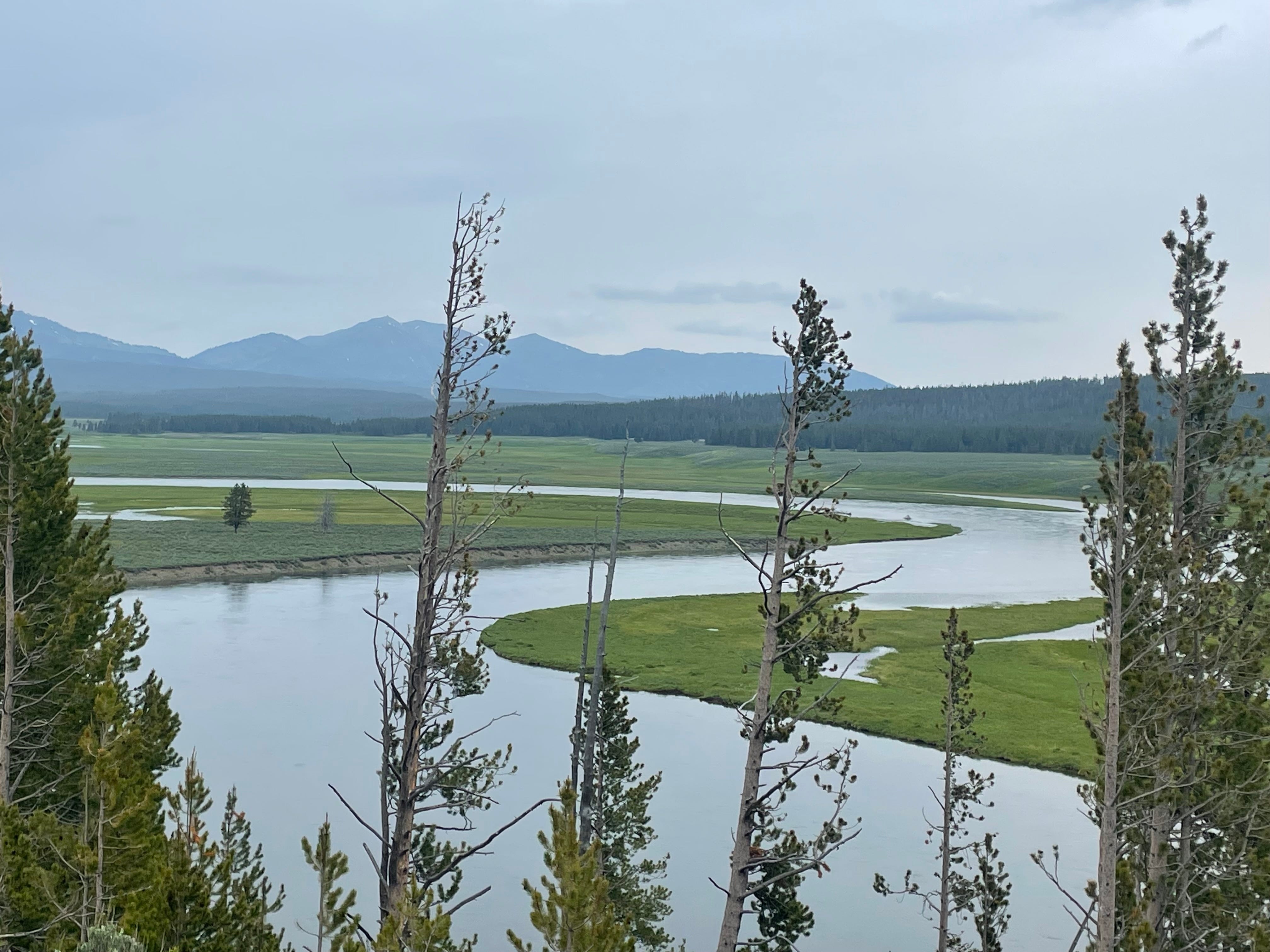
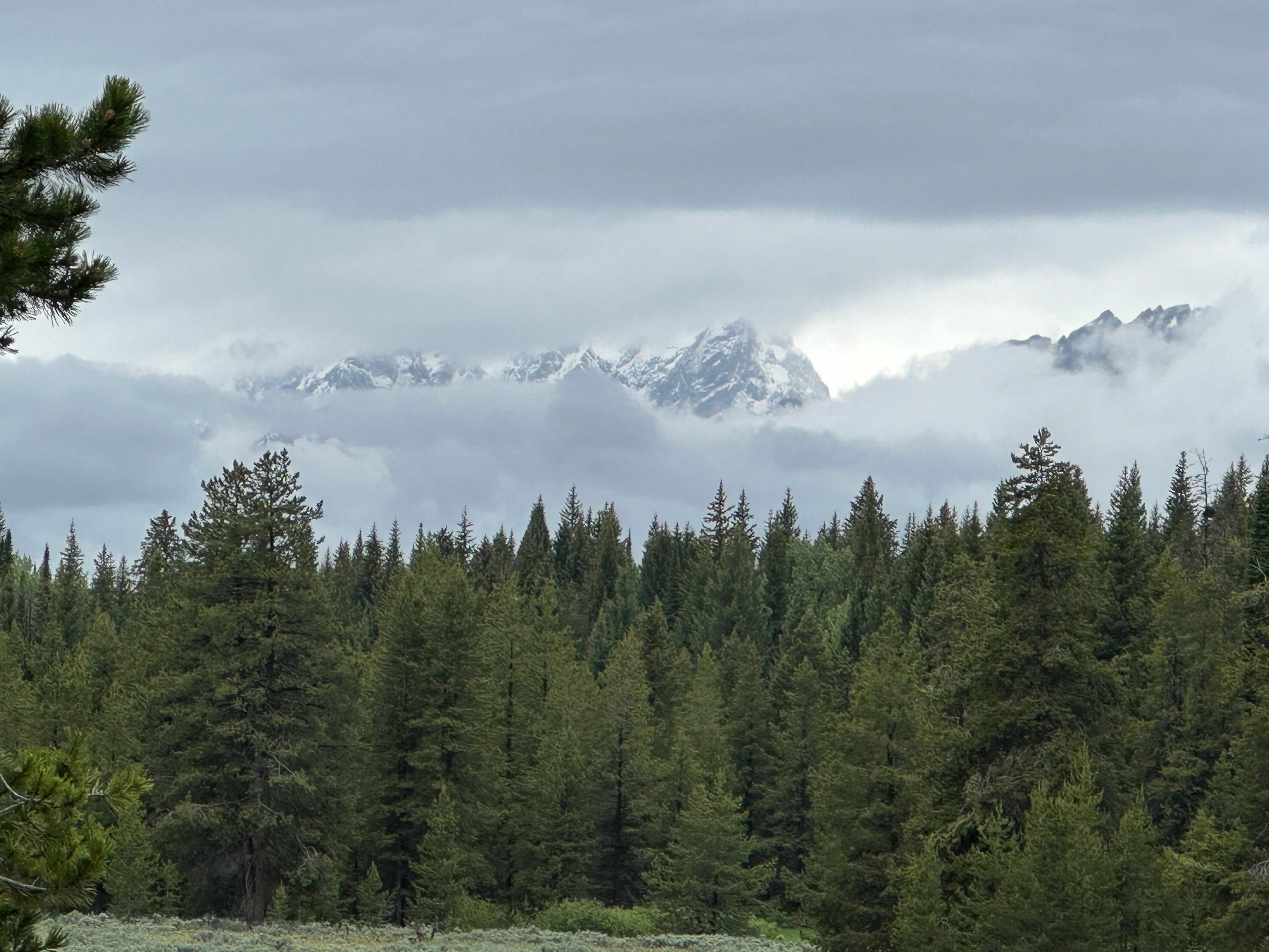
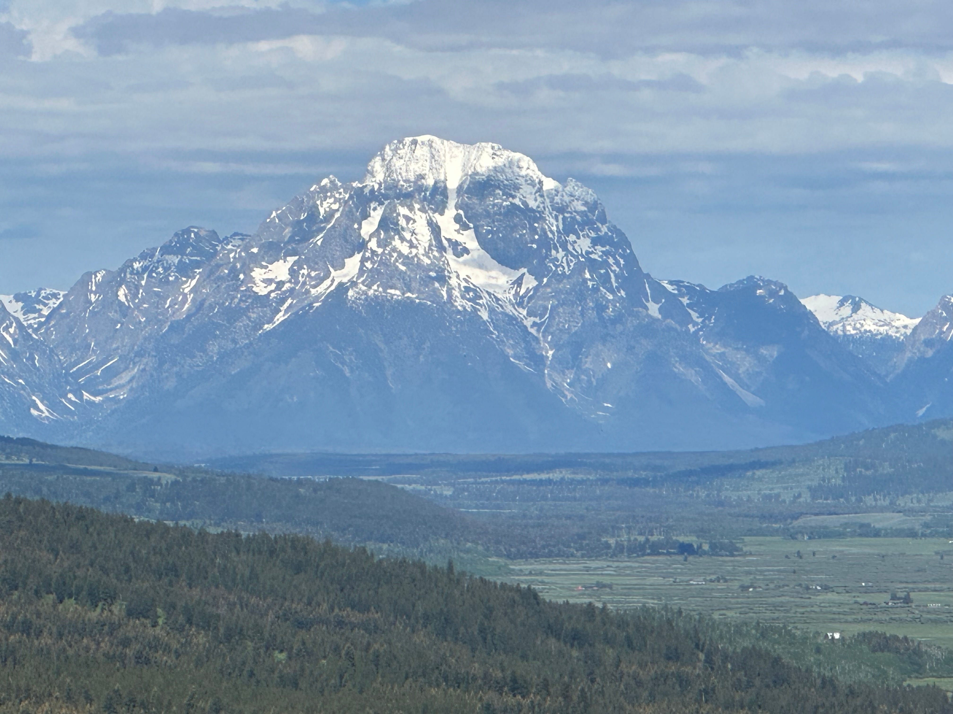
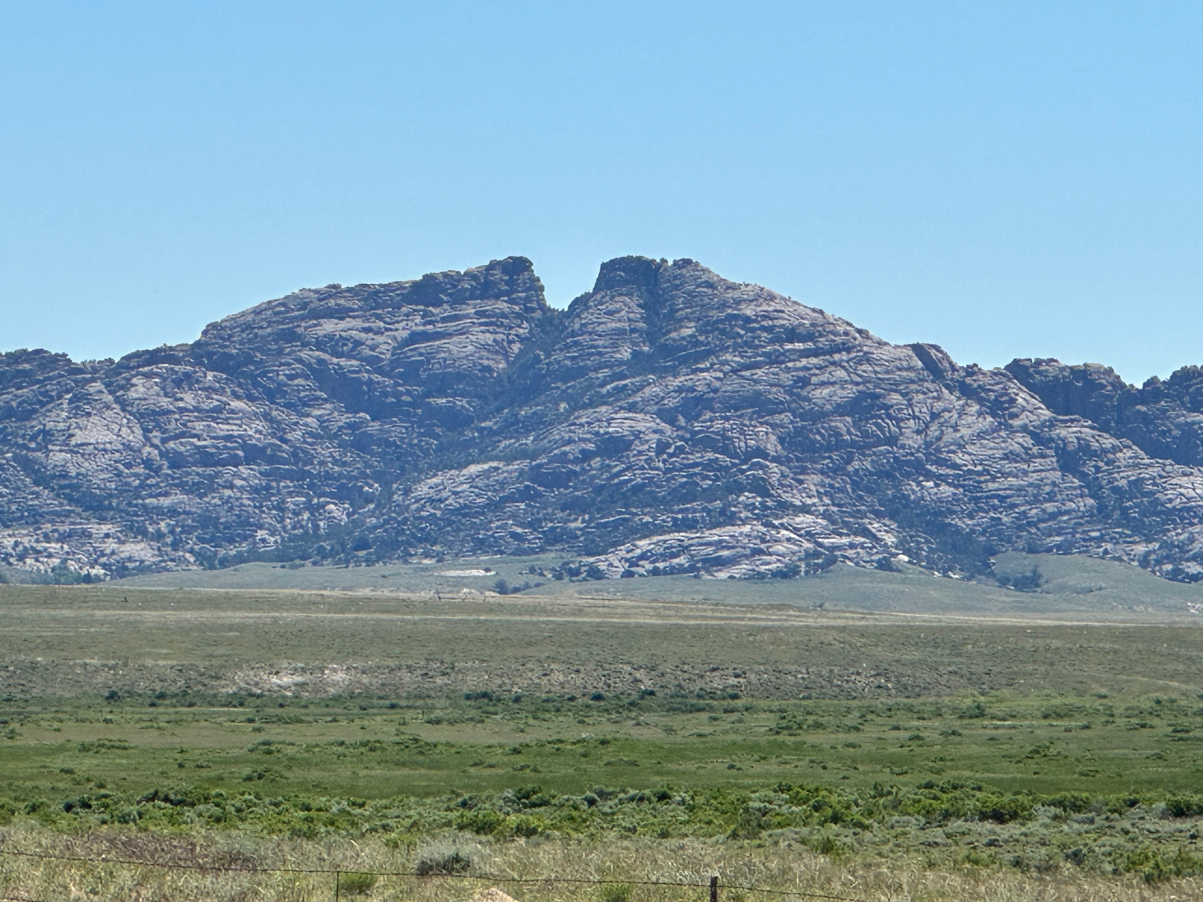
Despite the cars and the crowds, Yellowstone is undeniably fantastically beautiful, and I do not mean to downplay the positive aspects of our ride through the park. We bike about 175 miles, all told, within the park proper, exiting south along Yellowstone Lake and Colter Bay. We hit several of the Park highlights, including the Grand Canyon of the Yellowstone, a number of hot, bubbling springs, and Yellowstone Lake. Although we did not enter Grand Teton National Park, instead biking further east towards the Wind River Range, the mountain views were incredible. I realize that we have just scratched the surface of the Park, and could easily spend a couple of weeks here, especially if hiking is also on the itinerary.
Leaving Yellowstone - Wind River Range and Indian Reservation
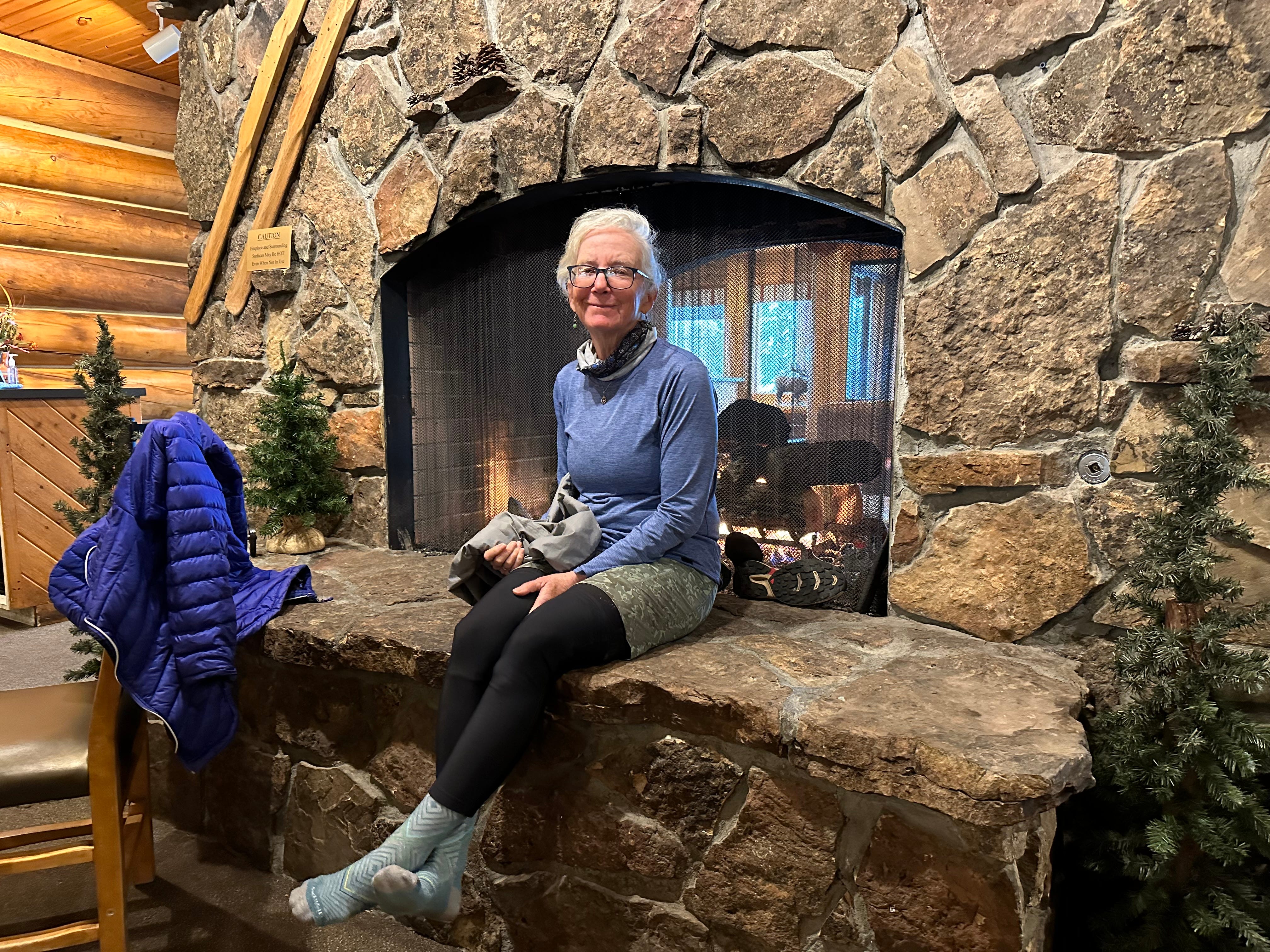
Skirting the Grand Teton National Park, we bike southeast towards the Wind River Range, and the large (2.2 million acres) Wind River Indian Reservation that sits on the east side of the range. On the way out of Yellowstone (north of Jackson Lake), we encounter a group of about ten Great Divide Mountain Bike racers, on their way from Banff, Alberta to Antelope Wells, NM. It is a rainy and cold day and we have splurged on a typically way overpriced lodge, with a nice, warm, fireplace.
The racers have been battling mud for a couple of days and are completely encased in the stuff, as are their bikes, when they arrive at the lodge (located along the John D. Rockefeller Highway). They use the lodge’s wifi to re-establish GPS coordinates and to contact friends and family. They are also drying off, warming up, and spraying mud off of their bikes. We chat amiably for about 1/2 hour. A majority are not from the United States, but most speak English. I notice that they are all glancing at their watches, clearly thinking about what is coming next. One by one, they quietly slip back into the woods, and on to the Great Divide trail, racing once again. It will take most of the racers at least another few weeks to make it to New Mexico.
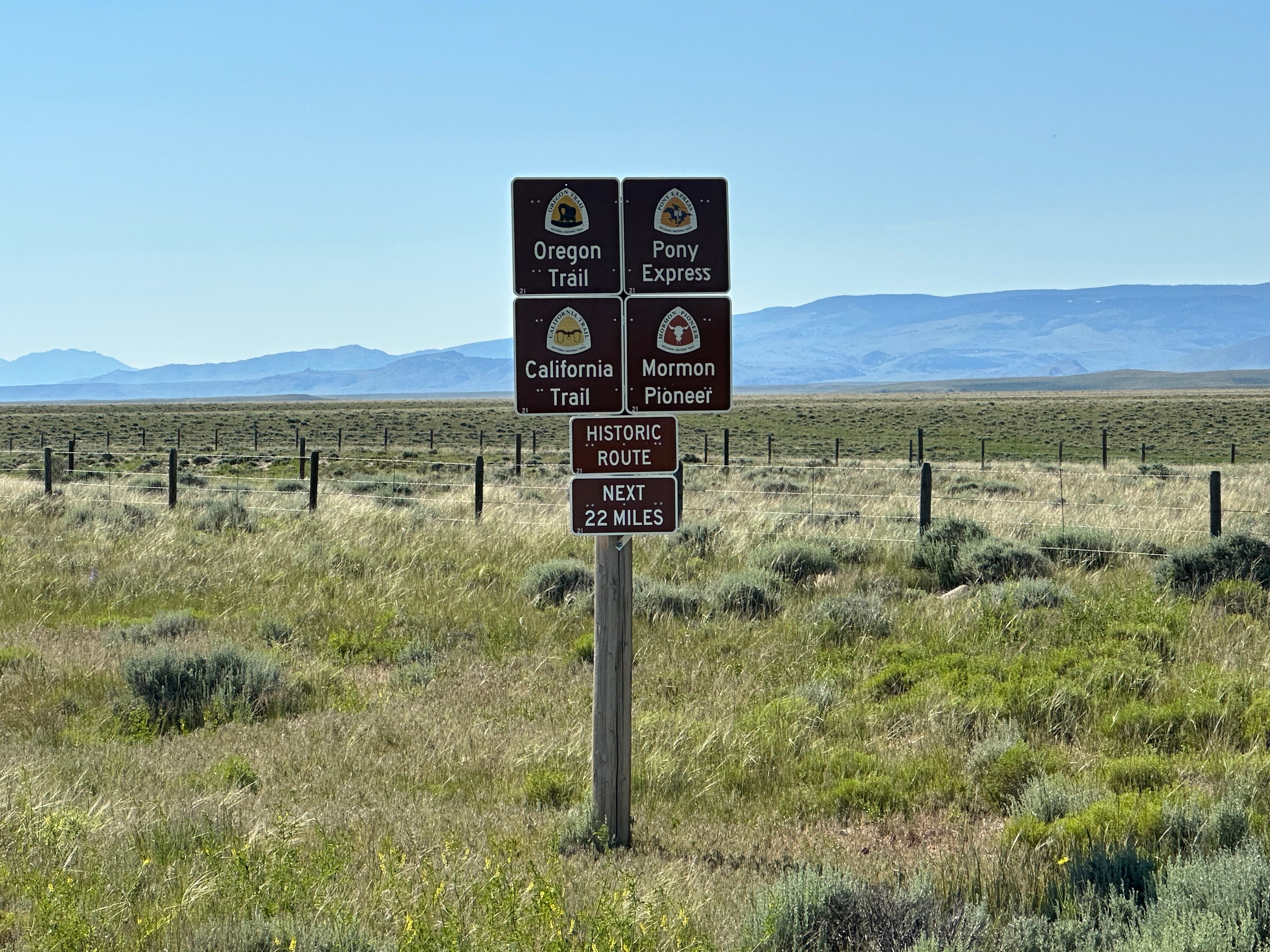
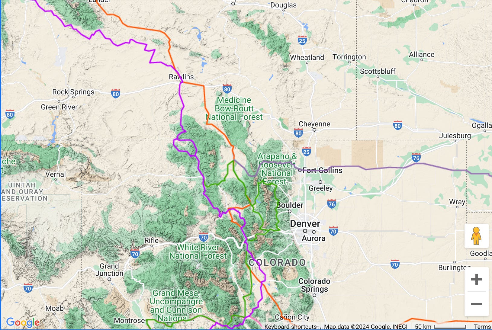
We consider picking up the Great Divide trail at around this point and following the racers into the woods for some distance. This would have eventually taken us into the “Great Basin” west of the Wind River Range, but also allowed us to then pick up our general route towards Denver. We have decided by this time to cross the Rocky Mountains from Walden, Colorado to Fort Collins, Colorado, and then head south along the Front Range of the Rockies to Boulder and Denver. There are a number of crossing points, but this seems to have the least altitude, and perhaps the easiest grade. The racers will stay generally west, using Steamboat Springs as a rest stop. We ultimately decide to take the easy way out and remain east of the range, generally on pavement, through the Reservation.
The ride to the Wind River Range is spectacular as we climb and leave the Tetons behind, crossing the Continental Divide in the process.

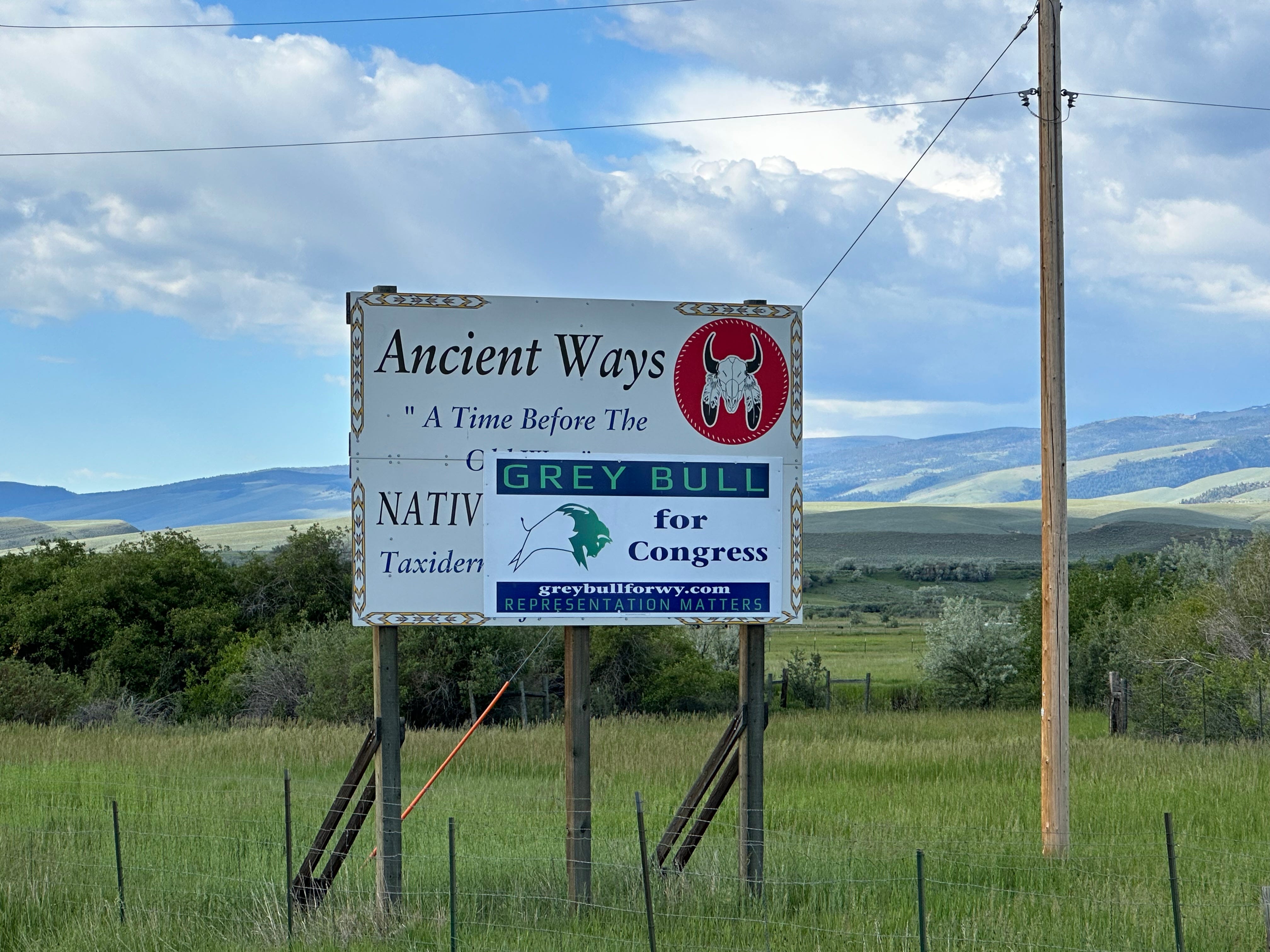
The Wind River Indian Reservation, with its capital at Fort Washakie, has a population of about 27,000 (15,000 are non-Indian), composed of both the Eastern Shoshone and Northern Arapaho tribes. Notably, Sacagawea, a famous guide with the Lewis & Clark Expedition of 1804 - 1806 is interred at Fort Washakie.
Our destination is a campground near Fort Washakie, the Wind River Basin Campground. It is noted in our Adventure Cycling Association materials, and we hope that it actually does exist. After cycling about 60 miles south along the east side of the Wind River Range, we see signs for Fort Washakie and, eventually, the campground.
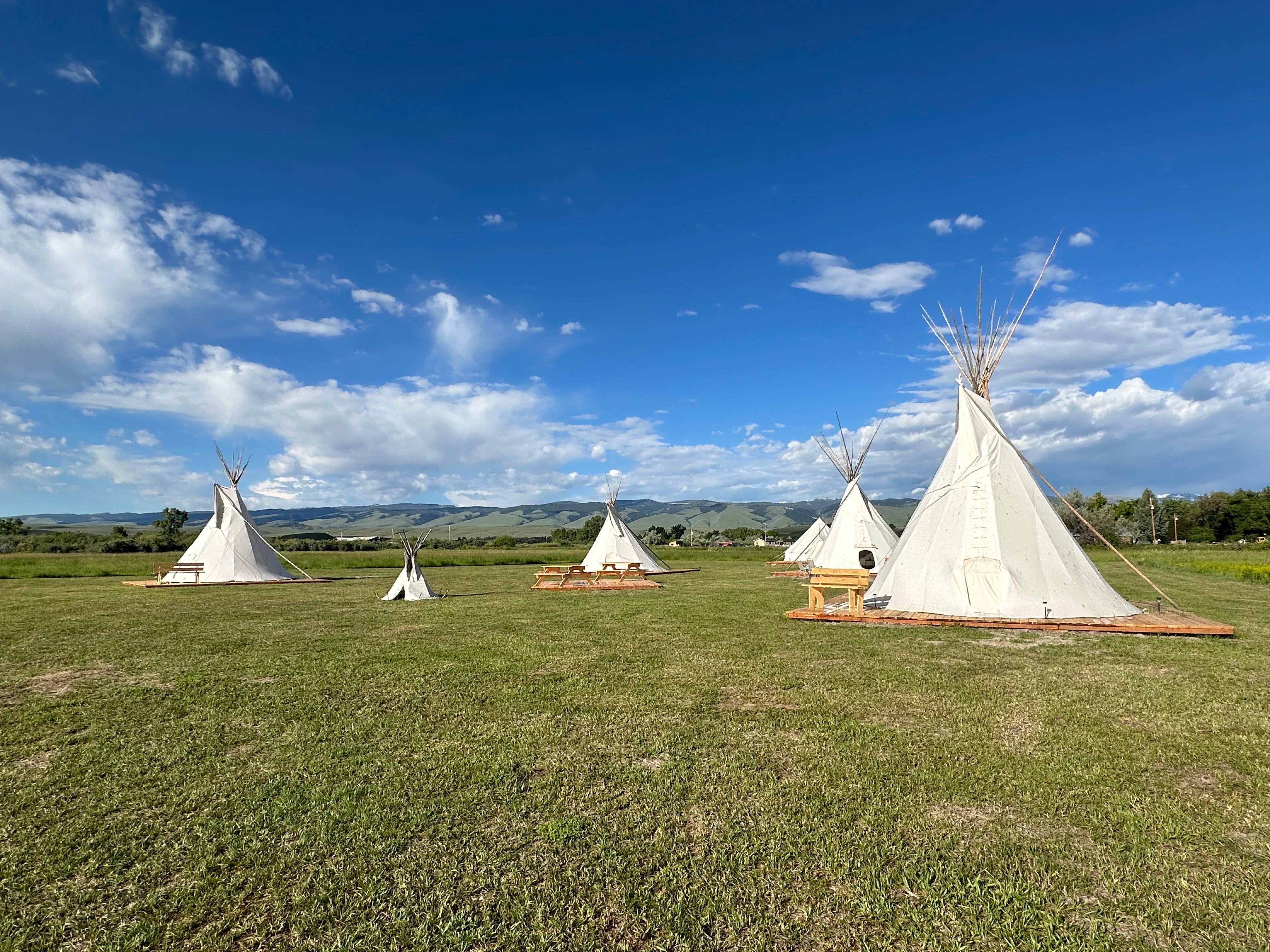
Wind River Basin Campground sits on a couple of acres of flat land, and is composed of 5 or 6 tipis. No one is there when we arrive, so we just poke around until a young man (Gerry) and woman (Erika) appear in a pick-up truck. They cheerfully provide us with water (there is no running water) and a variety of snacks, and show us to our tipi. The tipi is large, with two comfortable beds. We are among their first guests (ever), and they are still ironing out small details. The campground is entirely Native American owned and operated. We have a lengthy conversation and learn that they intend to place the campground on Airbnb, as well as other travel-oriented websites. They do not realize that the campground is on the Trans-America bicycle route, so we talk about how bikers will likely be showing up in large numbers as there are few non-stealth places to stay in the area.
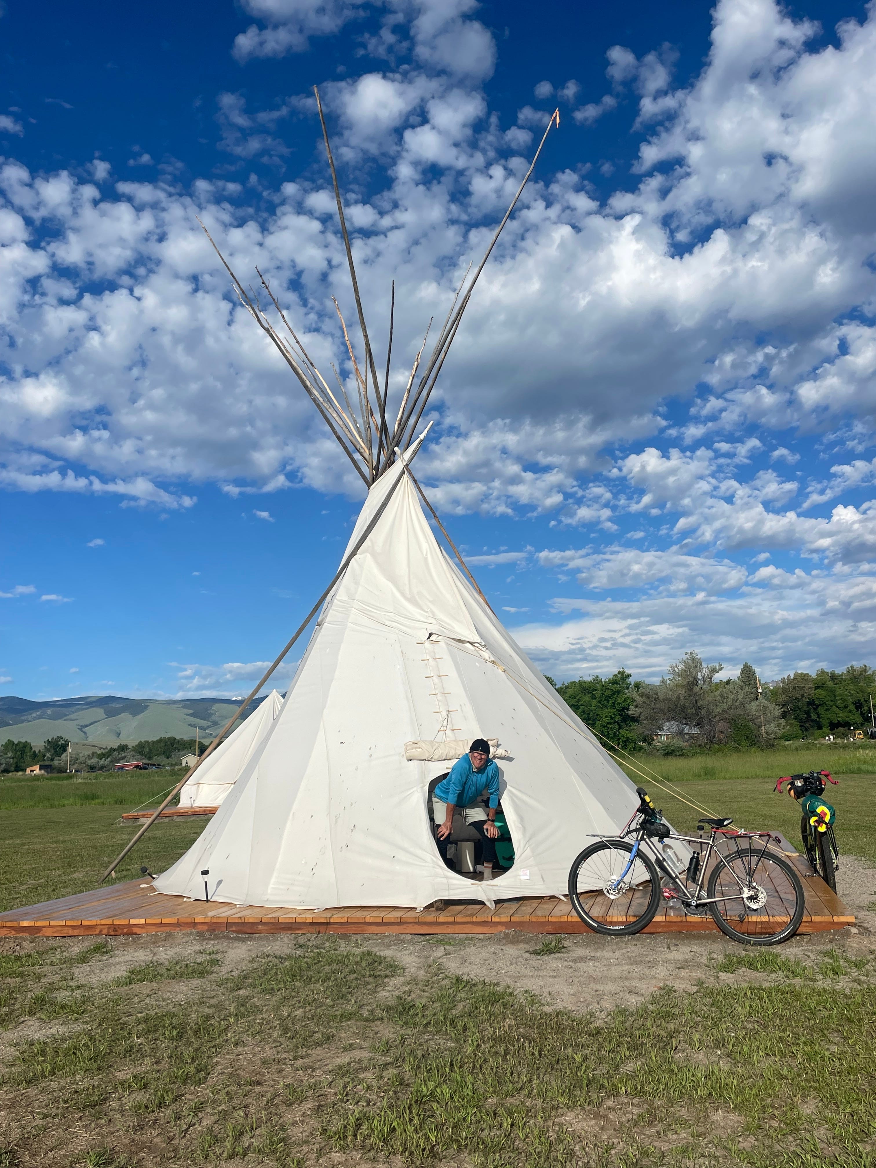
We are the only guests, and have a very quiet evening. There is some distant drumming, practicing for a pow-wow to be held nearby the following night. We leave early, just after sunrise, as it will be another long day with little in the way of services. Our destination will be around Jeffrey City (essentially a ghost town) where it seems that camping might be available. Our next major re-supply stop will be Rawlins, Wyoming.
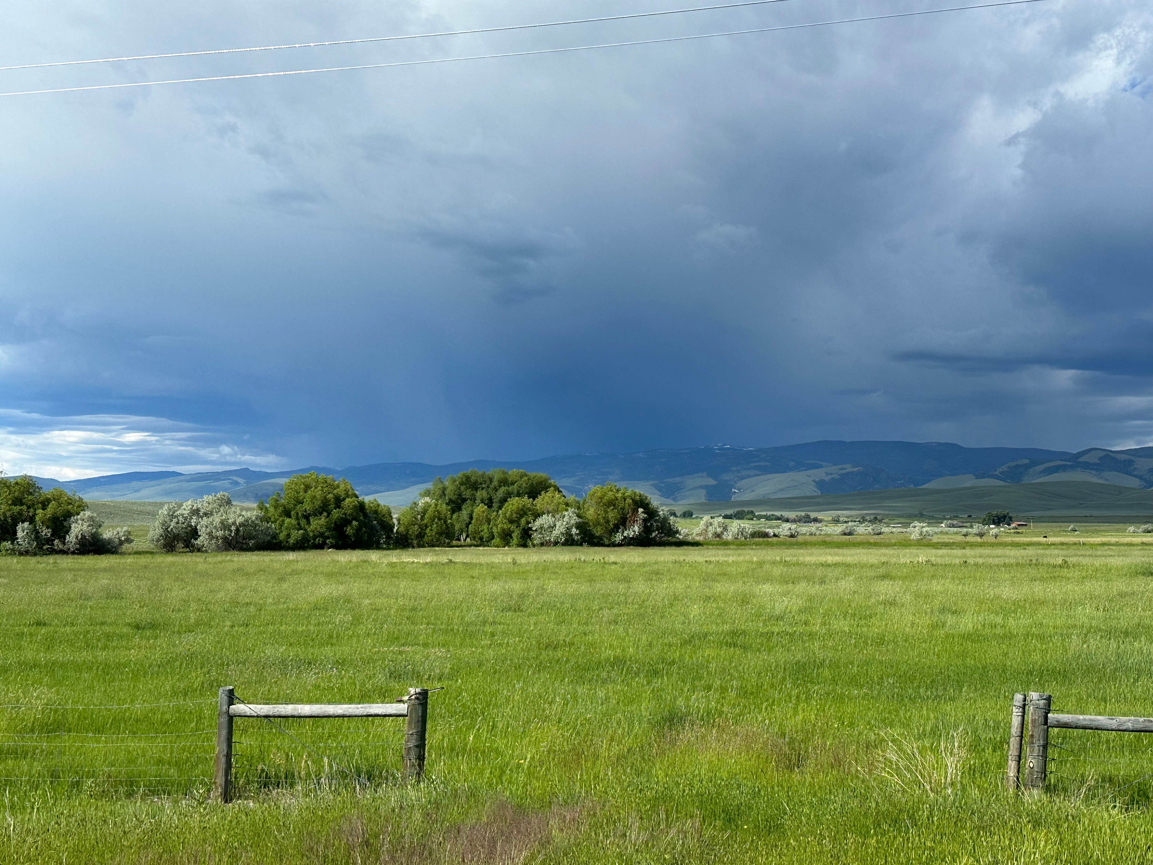
Soon after leaving the campground, it becomes pretty clear that a big storm will likely overtake us as we bike south. We are in the middle of a vast, open space with nowhere to hide. Thunder can be heard, and lightning seen. We have so far avoided getting caught in such a storm. We decide to start pedaling, fast, and try to make it to Lander, Wyoming, a small town about 10 miles away, where we can shelter.
It is amazing what fear will do in terms of physical response; fight or flight is real. We pedal furiously to make it to Lander before being overtaken by the storm clouds. Fortunately, the storm has produced a tail wind, so we fly into town (our version of flying is pretty laughable, but we are moving with all deliberate speed), just as the storm hits. We find ourselves at a grocery store where we meet a couple of other bikers (from the Netherlands) and watch as the hail phase of the storm passes through.
Sagebrush and Pronghorns
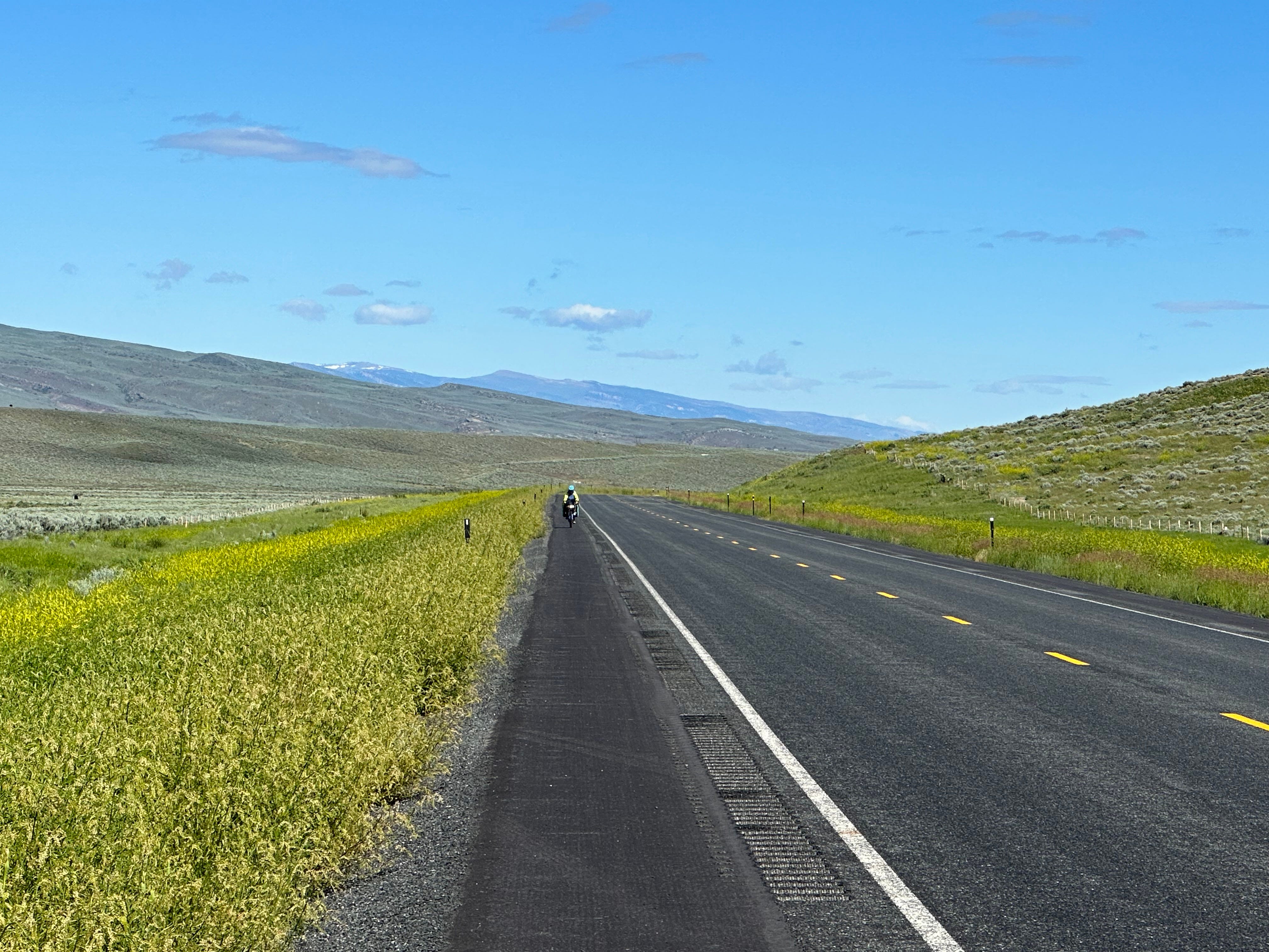
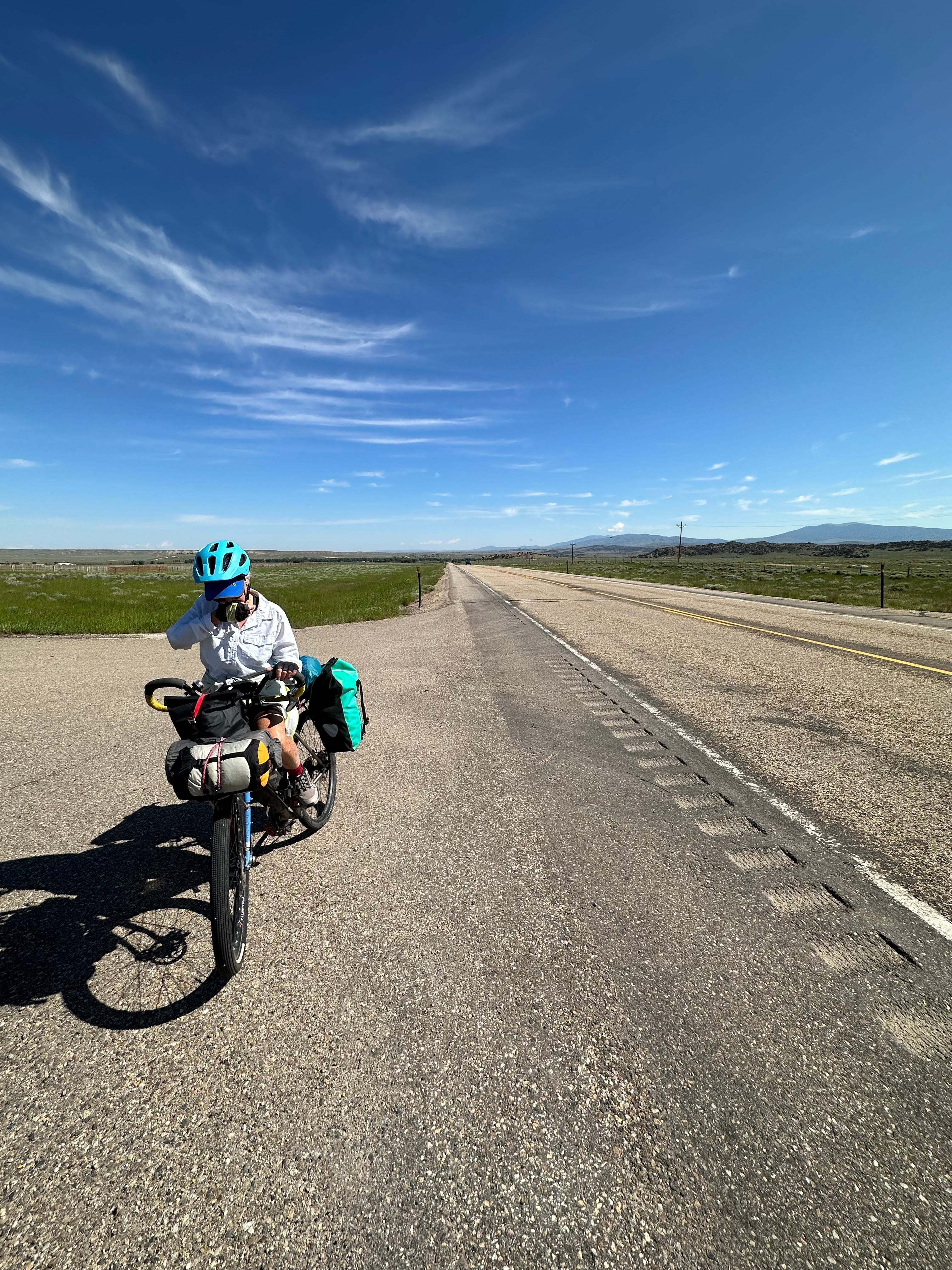
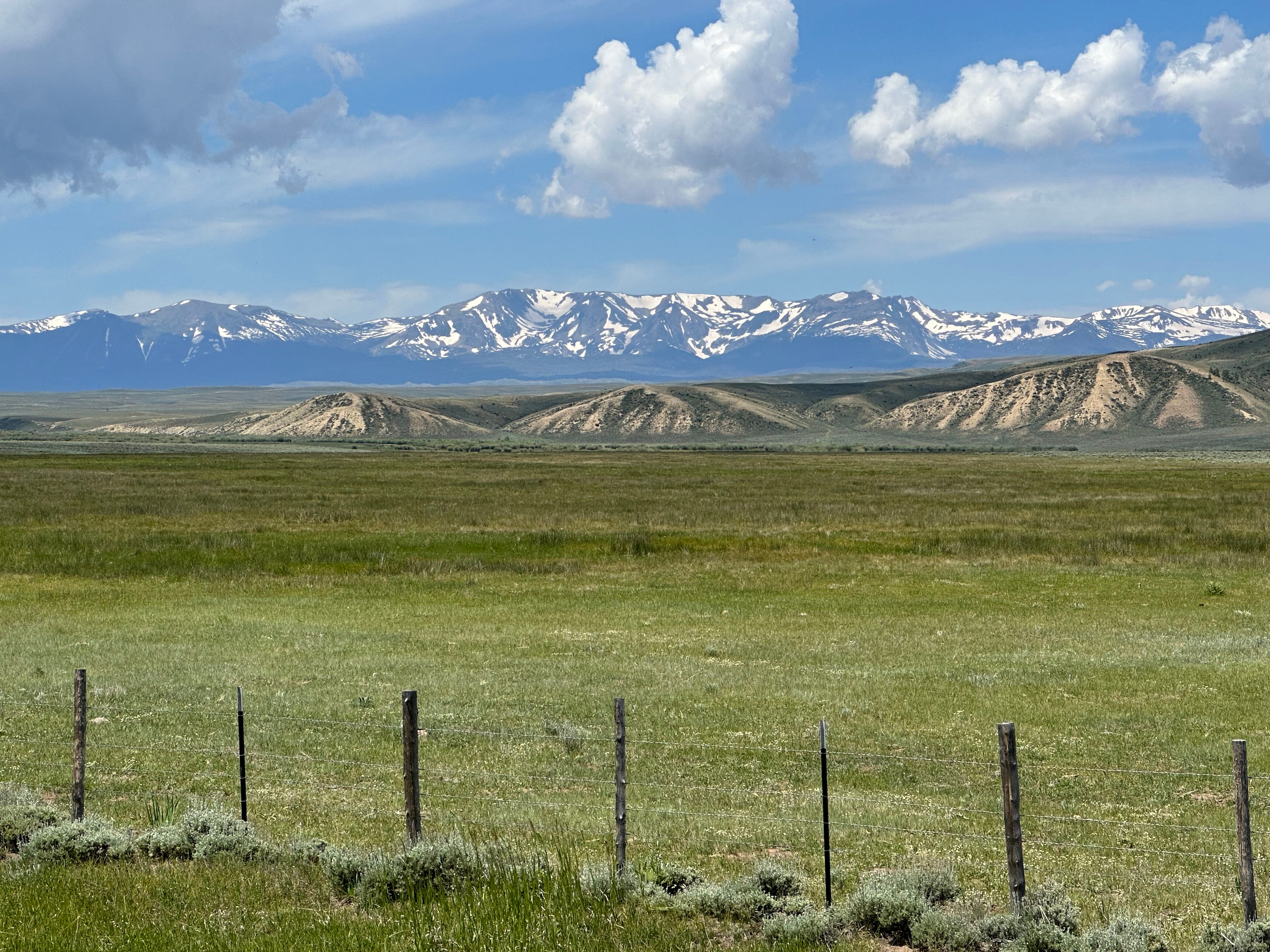
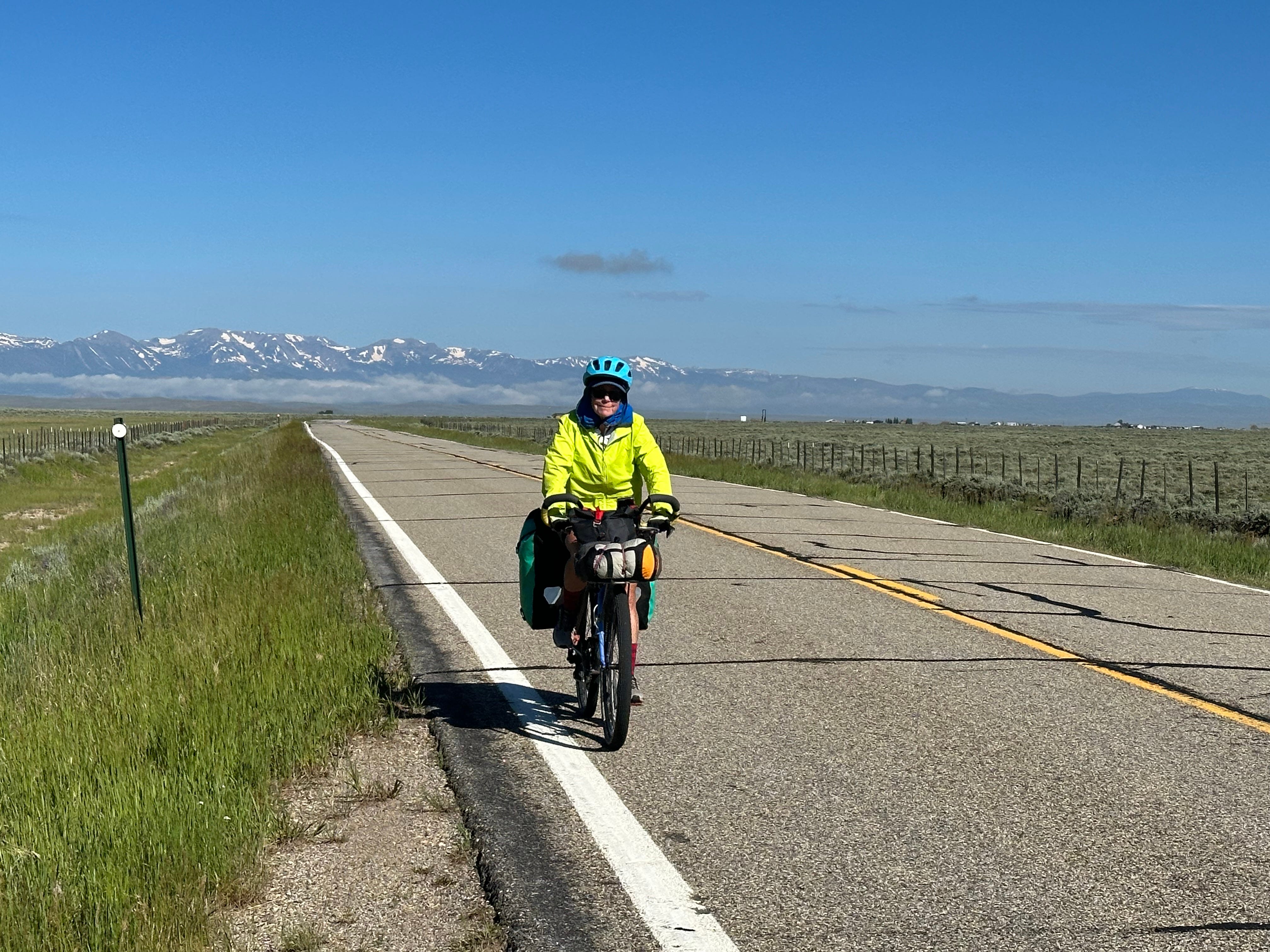
The next section of the ride takes us through miles and miles of what has become soggy wild sagebrush on both sides of the road. We are riding through part of the “Great Basin.” Indeed, we hammer out an 80 mile-plus ride into a very remote area of the route that requires some judicious water management. Given our conservative tendencies (from a bike touring or bikepacking perspective), we typically shy away from such scenarios, but sometimes it is not possible to avoid them. It reminds me a bit of Baja in terms of remoteness. We slip into something like survivor mode, aware that although we are not in truly remote territory (we are, after all, on a road as opposed to an off-road trail in the middle of the desert) care must nevertheless be taken and situational awareness is a must. It is actually quite a lot of fun.
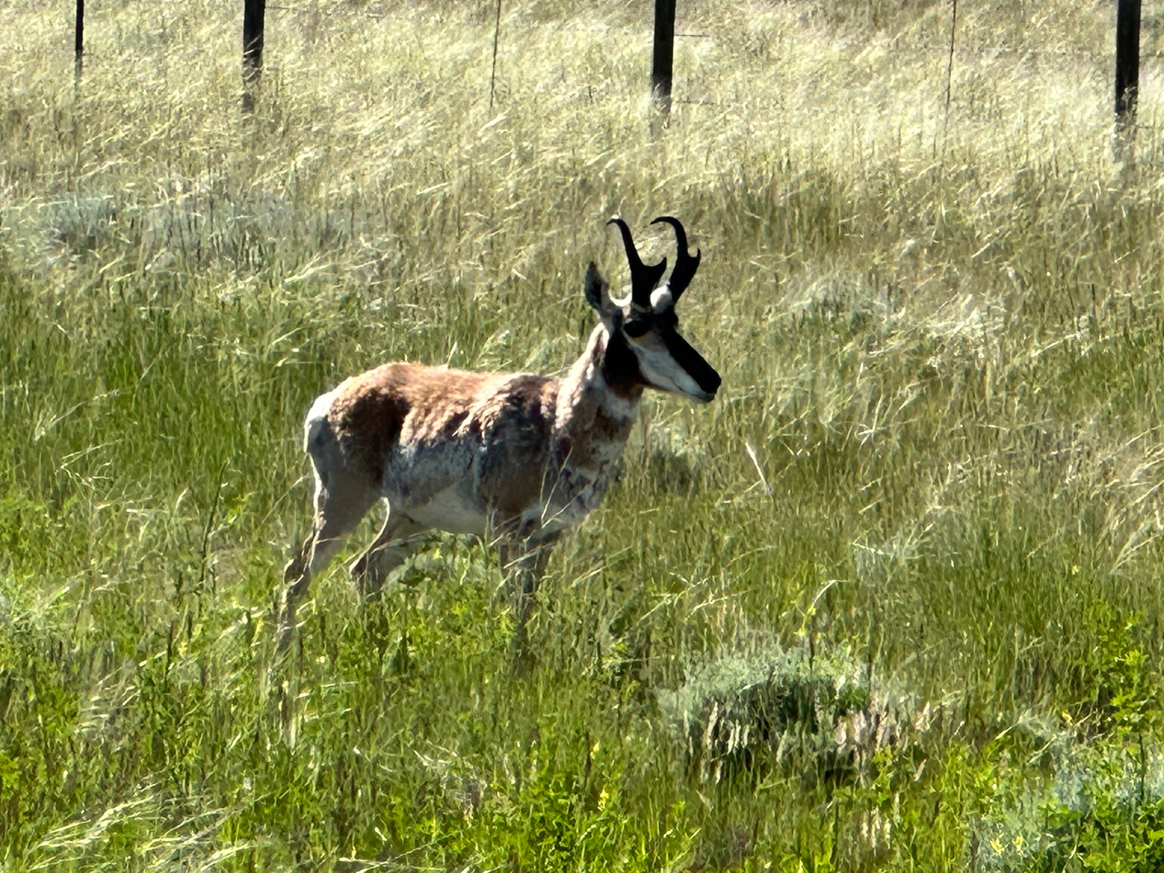
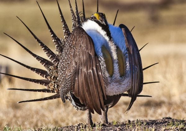
I later learn that sagebrush - artemisia tridentata - is not sage. Sage (the spice) is a member of the mint family; sagebrush is a member of the sunflower family. But, of course, sagebrush flowers are nothing like sunflowers, being wind pollinated as opposed to insect-pollinated. I was also unaware that there are more than 350 species of artemisia, some of which are called wormwoods. Sagebrush habitat is critically important to the greater sage-grouse, and the destruction of sagebrush habitat due to over-grazing, fire, and invasive species is endangering this fine bird (of which we see zero). Many other species also rely upon this woody-stemmed evergreen shrub, including deer, elk, antelope and pronghorn (pronghorns are, apparently, not technically antelope).
We pass quite a few signs indicating that scientific sagebrush research is an ongoing enterprise in this region.
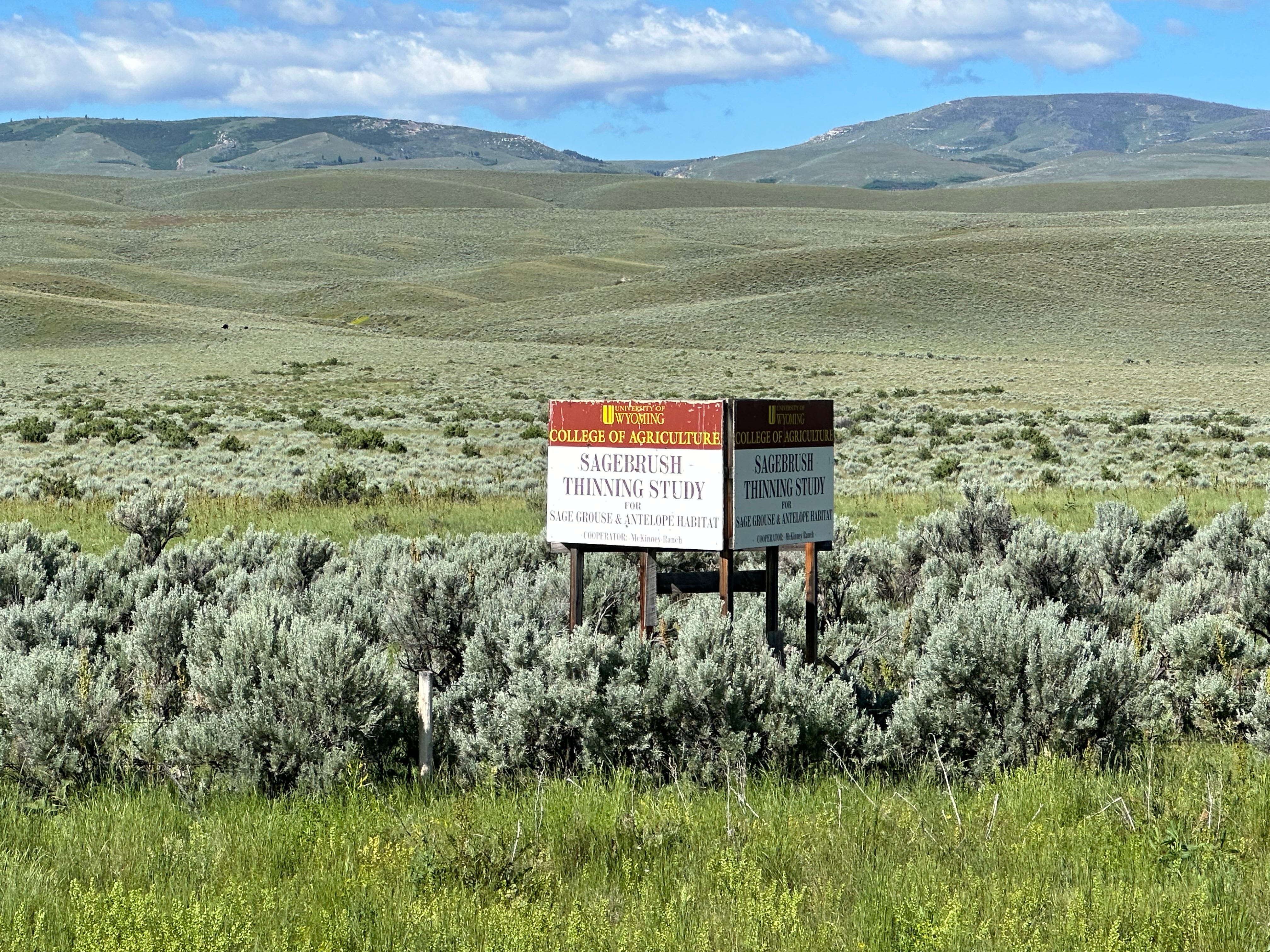
Interestingly, biologists from the Institute for Applied Ecology have partnered with the Departments of Correction in many northwest states to grow and plant sagebrush by the thousands of plants. “As of the end of 2017, nearly 900,000 sagebrush have been planted on public lands through the Sagebrush in Prisons Project to restore burned areas and support the the greater sage-grouse, an imperiled species.” Here is a link to an odd little video describing the project, which uses prison labor to plant the sagebrush.
As we cruise through sagebrush country we are accompanied by millions of mosquitos. Unfortunately, this is how I will remember sagebrush and sagebrush country. Because of the recent heavy rains, there is a lot of standing water in the sagebrush terrain. We have seen cattle standing in such water coming up to their knees (I think cows have knees?) Mosquitos, in clouds, descend upon us if we stop for even a few seconds. Bug repellent does not seem to work so well. We consequently must push-on, but it is a real problem. Many are able to come along for the ride as they hang-out, buzzing, around us. They are, I later learn, very agile and efficient flyers, capable of adjusting their flight speed to match that of a moving object like a bike with a person on it.
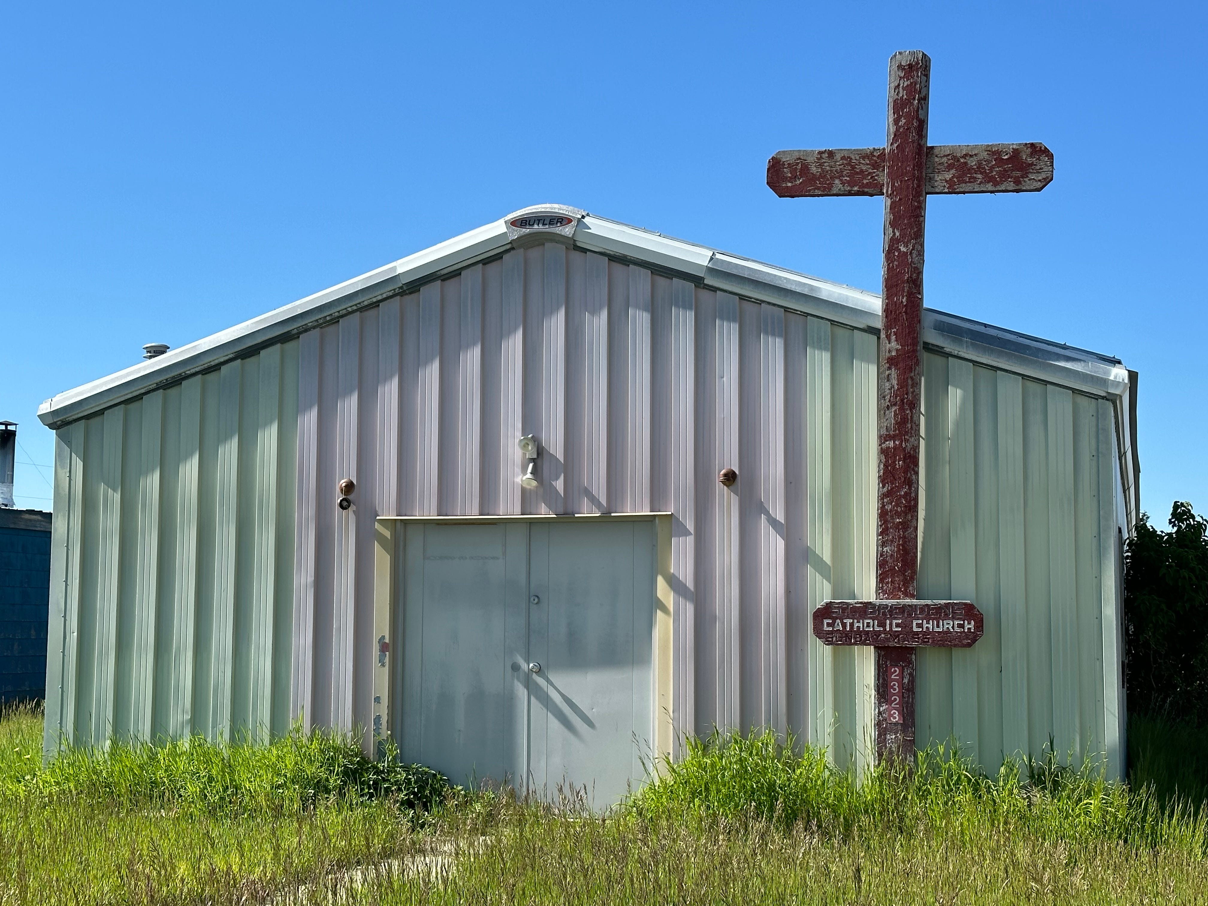
We consider stopping in Jeffrey City, our original destination, a ghost town along the route where our ACA materials tell us a hostel of sorts, exists. We arrive in town and, as a ghost-town should, appears quite deserted. A lonely church building still remains, as do other ramshackle structures, but we cannot find a single person around, let alone any accommodations.
We later learn from some other bikers that there is, in fact, a funky hostel within the “city” limits. I am surprised. No matter, we press on to an alternative camping destination for the night, Sweetwater Junction.
Late in the day we finally arrive at Sweetwater Junction, a fairly bare bones, but nice, State of Wyoming rest area sitting in the middle of nowhere, at a highway intersection. Rolling in, we see small sheltered cement huts with picnic tables, a playground area for kids, bathrooms, and a large parking area. We eye the little huts. We search for signs that say “no camping” and we do see a small one. But we are convinced that the ACA materials are pointing us to this little rest stop, so we choose willful ignorance.
We decide it is best to wait until dark to set up the tent under one of the cement structures. By 8:30 the tent is up (for anyone who is interested, it is a free-standing 3-person Marmot) and pretty well hidden. We try to act normal, read, and plan for the next day’s ride. Sleep beckons, and we don our eye masks and ear plugs (trucks continue to enter the area frequently). Just as we are settling down for sleep, I spy a Wyoming ranger-type person circling around the area in a police-looking car. It is the first “official” vehicle I have seen all day. It seems to be passing by our hut, and I start to sigh in relief to myself. Suddenly, it stops. Out pops a uniformed woman in her 50s who walks quickly and directly to our little shelter. She loudly says, “hello!” We play possum, pretending not to hear. She then kneels and sticks her head right outside the tent door: “You can’t be here!”
After trying to discuss how wonderful biking in Wyoming had been, we engage in a fairly lengthy, if not lawyerly, conversation regarding the rules. We tell her all about our ACA materials and how this spot is on our bike route, blah, blah, blah. She is unmoved and clearly worried more about the ramifications for her should she let us stay, than sending us out into the dark Wyoming night on our bikes.
Without shame, I ultimately play the age/injury card, explaining to her that my recently (OK, it was 10 years ago) replaced knees were acting up, we had biked 80 miles earlier in the day (true), and simply could not bike another mile (also true). Plus, Pam’s flowing white hair is evident, and I don’t even have hair. Would we be fined, arrested? This entire conversation takes place while we remain reclined in the tent, covered by sleeping bags. We really do not want to move.
After about 1/2 an hour she finally determines that we are not a threat to public order. Using whatever discretion she has, the officer finally gives up, and just walks away, telling us to be out early and to never do it again. She is a good sport, and I think she never even tells her superiors about the encounter; otherwise, she might have been required to remove us.
After the ranger leaves, we consider our privileged good fortune. If we had been any other color than white, or a younger couple less able to engage, or a single male with a jacket for a blanket, the result would have been different, I am certain.
We were presented with a very similar scenario 42 years ago during our first cross-country bike trip. I had long hair and an earring no less. Pam looked every bit the hippie she was. We were biking through central Kansas and ended up camping in a small town park. It was a Mennonite community, and people were outwardly, at least, friendly. We arrived late in the day, hung around, chatted with some local people, made dinner and set up the tent. All seemed cool. We fell asleep. Awakened literally at midnight by two cops, we were forced to take down the tent and pack everything (including the bikes) into a pick-up truck. We were then unceremoniously driven a mile outside of town, and told to camp in the woods on the side of the road. There was no discussion.
That was then, this is now.
We arise quite early (the trucks are relentless) the next day and continue our lonely (except for the mosquitos) ride to Rawlins, Wyoming. This would also be a long day with just one fairly dismal little store functioning as our rest stop.
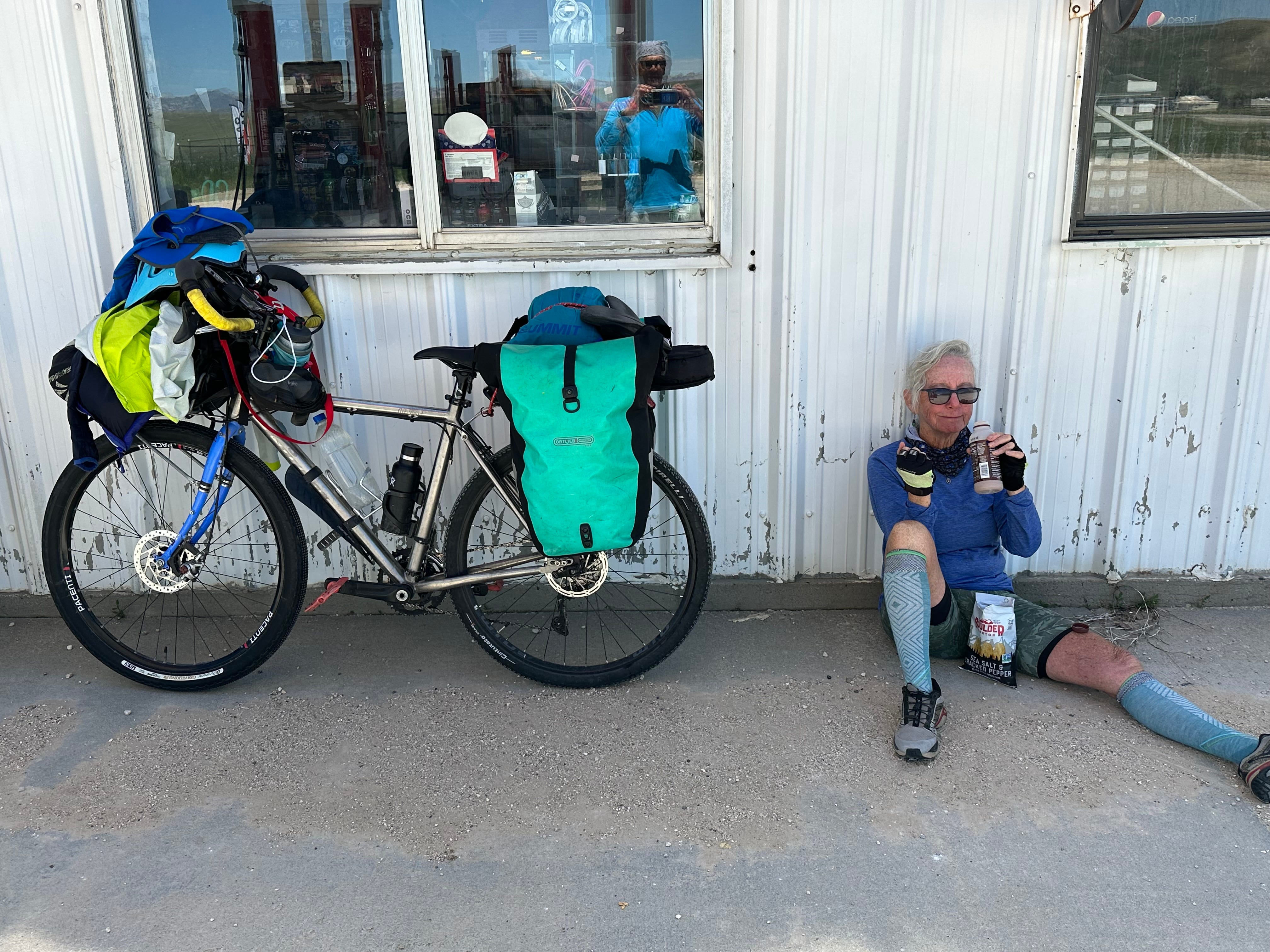
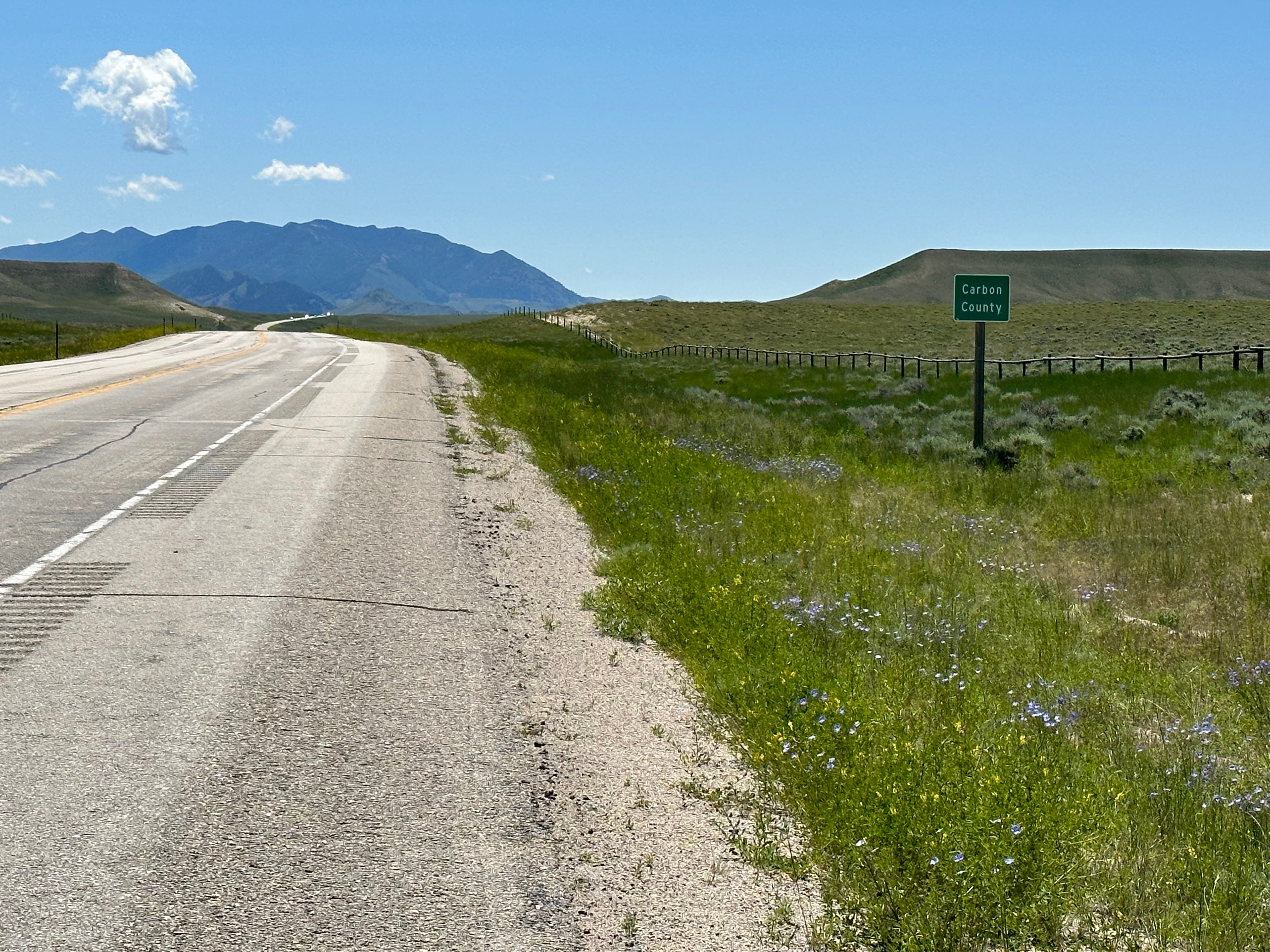
Rawlins (pop. 8200, county seat of Carbon County) is a well-known bicyclist rest stop; both Great Divide and Trans-Am riders use Rawlins to recover from the rigors of the Wind River Range area. Great Divide riders leave Rawlins to head more southwest towards Steamboat Springs, Colorado and the higher elevations in that area. Trans-Am riders (of which we are two, at least for the time being) head more southeast towards Walden, Colorado, where other routes also intersect, and the elevations tend to peak at just over 10,000 feet.
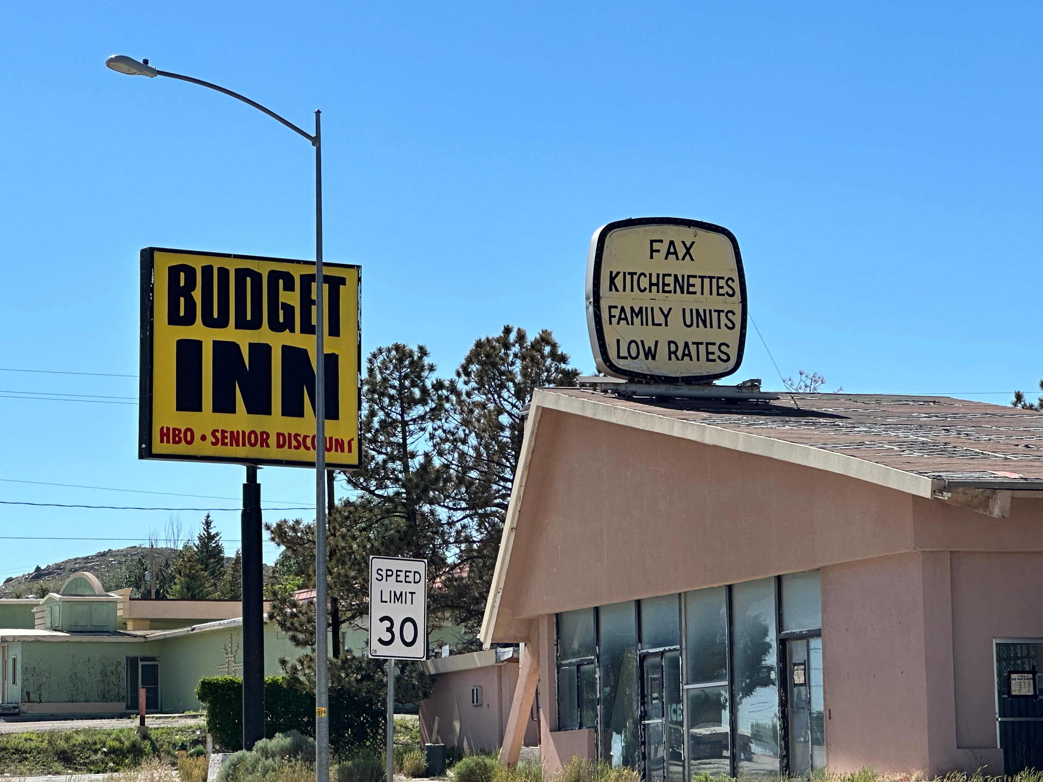
It is very hot and we decide to get a hotel for the night. Rawlins, despite its prime location as a bicyclist hot spot, has seen better days.
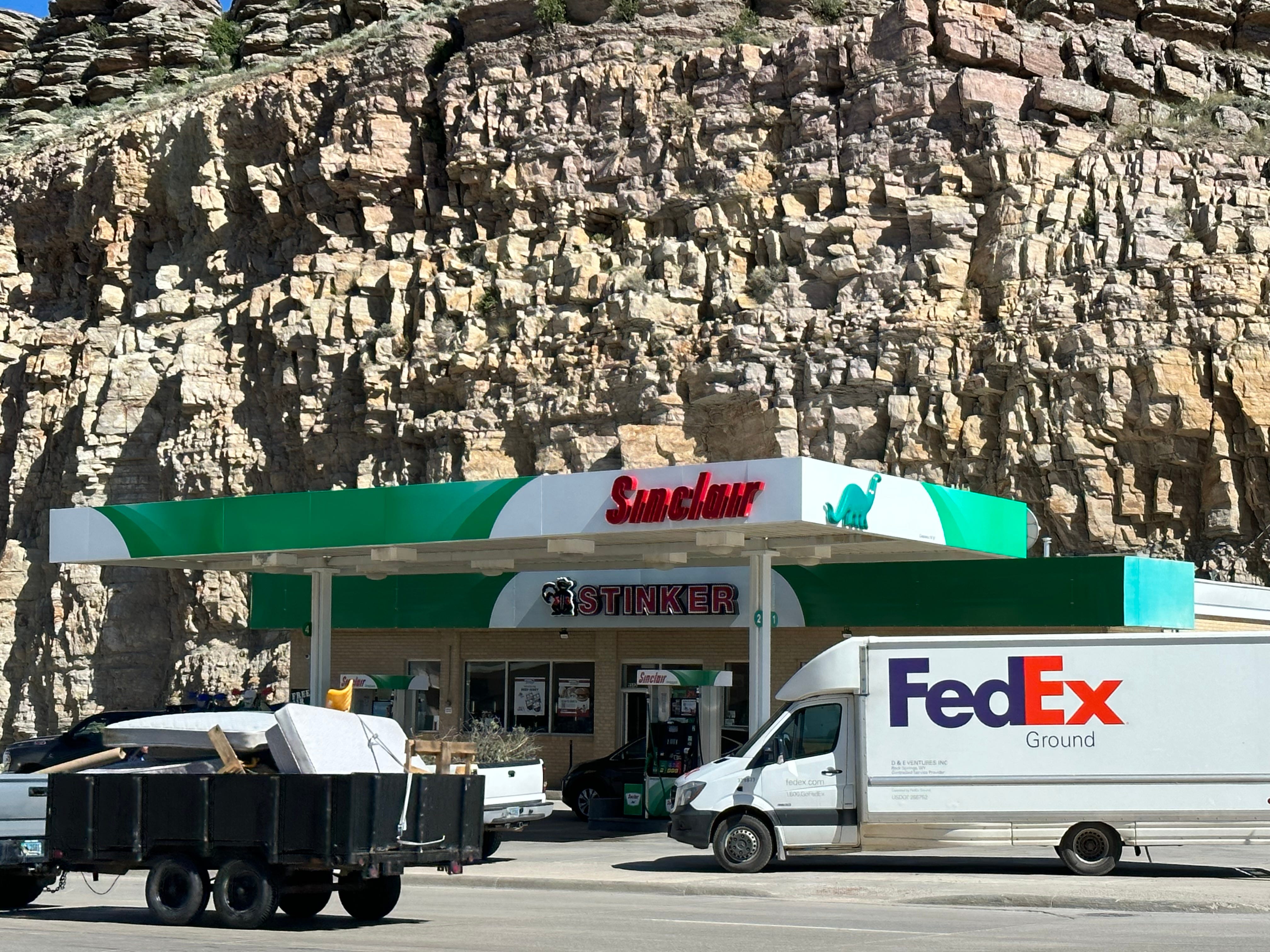
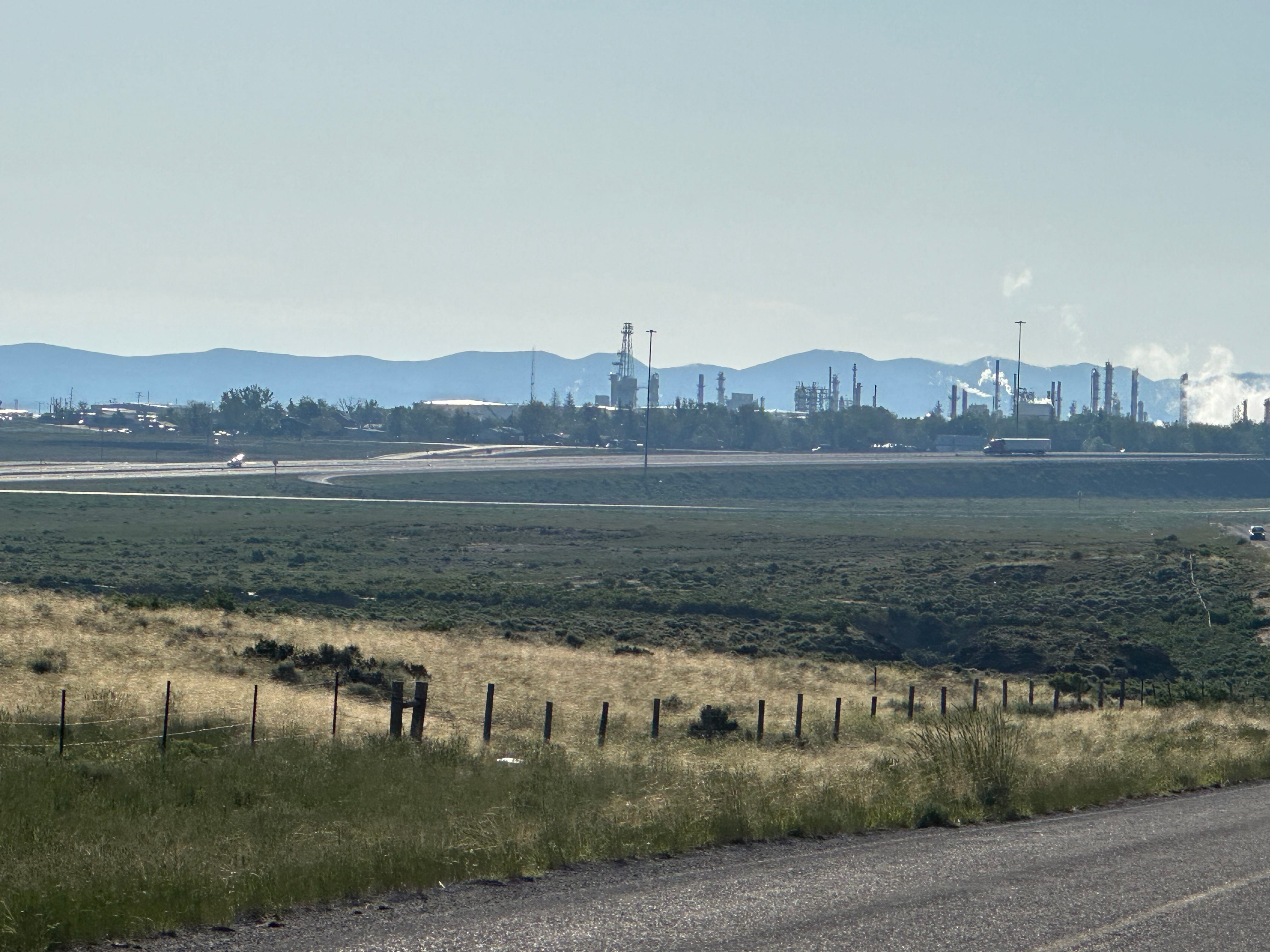
Immediately upon leaving Rawlins we enter Sinclair, one of the homes of Sinclair Oil Company. Remember Dino? I had a Sinclair Oil toy truck as a kid. Clever marketing. The Dino logo was developed in the 1930s by marketers capitalizing on the (erroneous) belief that the oil being extracted by the company was in part derived from the dead bodies of dinosaurs, fossils of which are found in the area (the logo is based upon an Apatosaurus).
Sinclair Oil retains a large refinery in Sinclair, Wyoming, in the heart of Carbon County. The refinery has been here since 1924 and produces around 85,000 barrels of oil per day. We don’t see much of Sinclair on the east coast; the Sinclair Refinery ships mostly to the West and Northwest. The Town of Sinclair has a population of just 433. It was built as a “planned community” in the Spanish Colonial style, bearing the name “PARCO” (Producers and Refiners Corporation). An unrepetent company town. The historic center, which is now a very nice little park in which we had breakfast and coffee, was renamed the Parco Historic District in the mid-1980s. Clearly benefitting financially from the huge refinery complex across the street, the Park is extremely well-tended. We tool around the town and the park, waving to the Sinclair truck drivers, before heading off to Walden, Colorado - a two day ride to the Rocky Mountains.
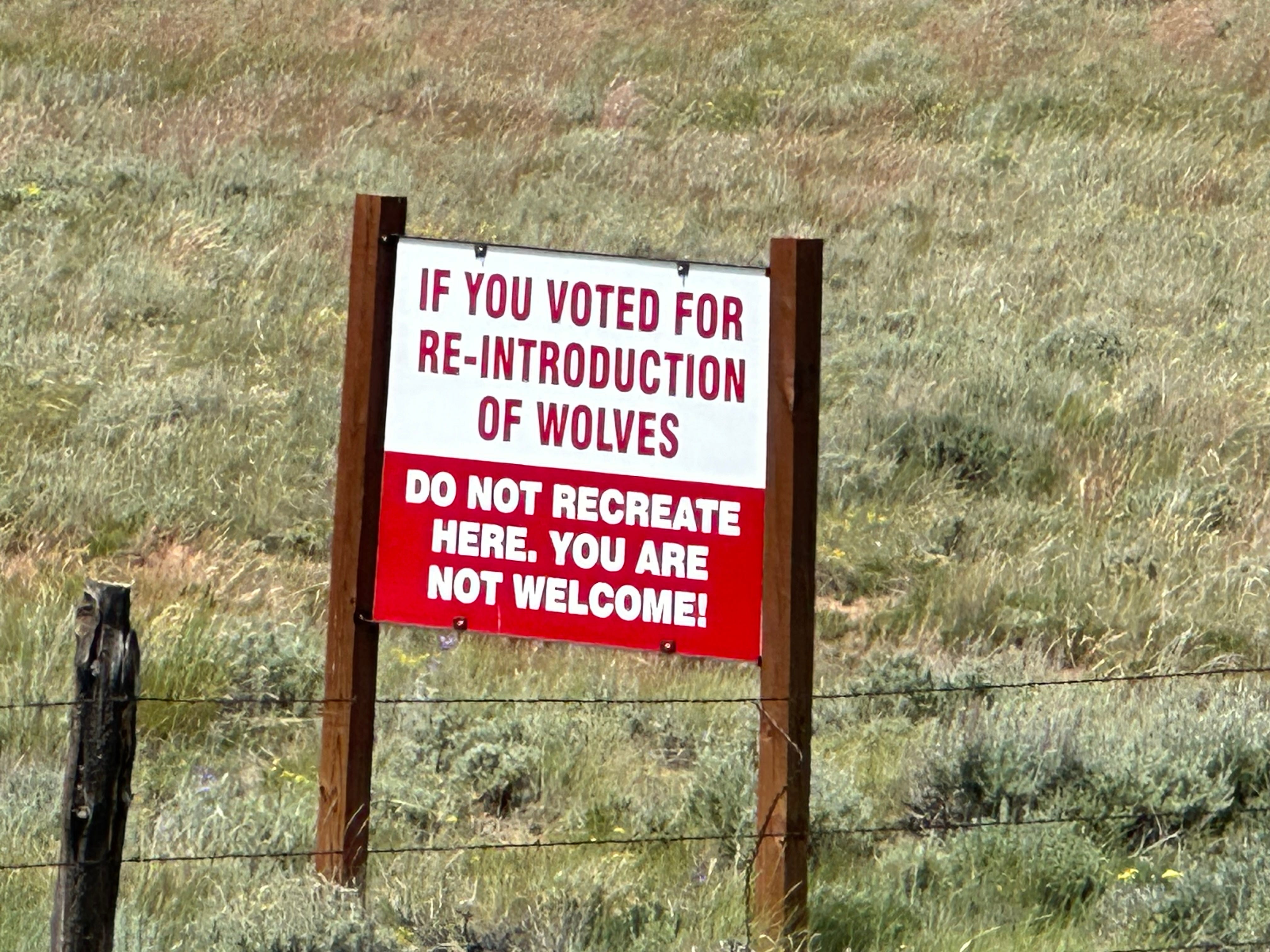
To be honest (I do generally dislike using that phrase, but here it is for emphasis), we are happy to be leaving Wyoming. I have refrained from complaining about Wyoming politics (Liz Cheney notwithstanding) mostly because I am just tired of complaining. Wyoming, well known as perhaps the most reactionary and conservative state in the country, was impossible to avoid, especially if we wanted to see Yellowstone. Plus, experiencing otherworldly sagebrush country on a bicycle was an unexpected highlight that I am glad we did not miss, despite the mosquito cloud cover. Level 2 fun all around.
PART II
Colorado - Destination Reached
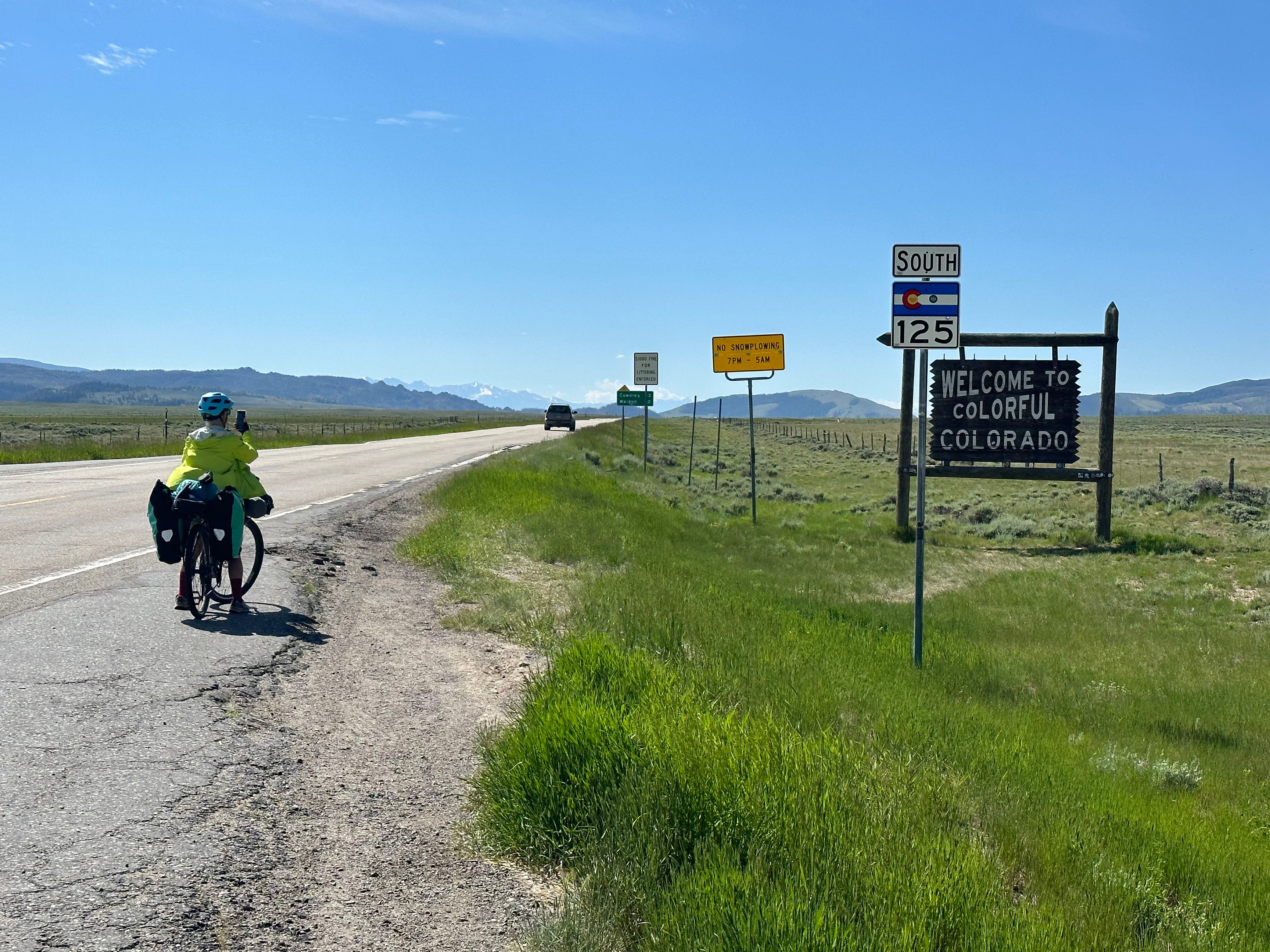
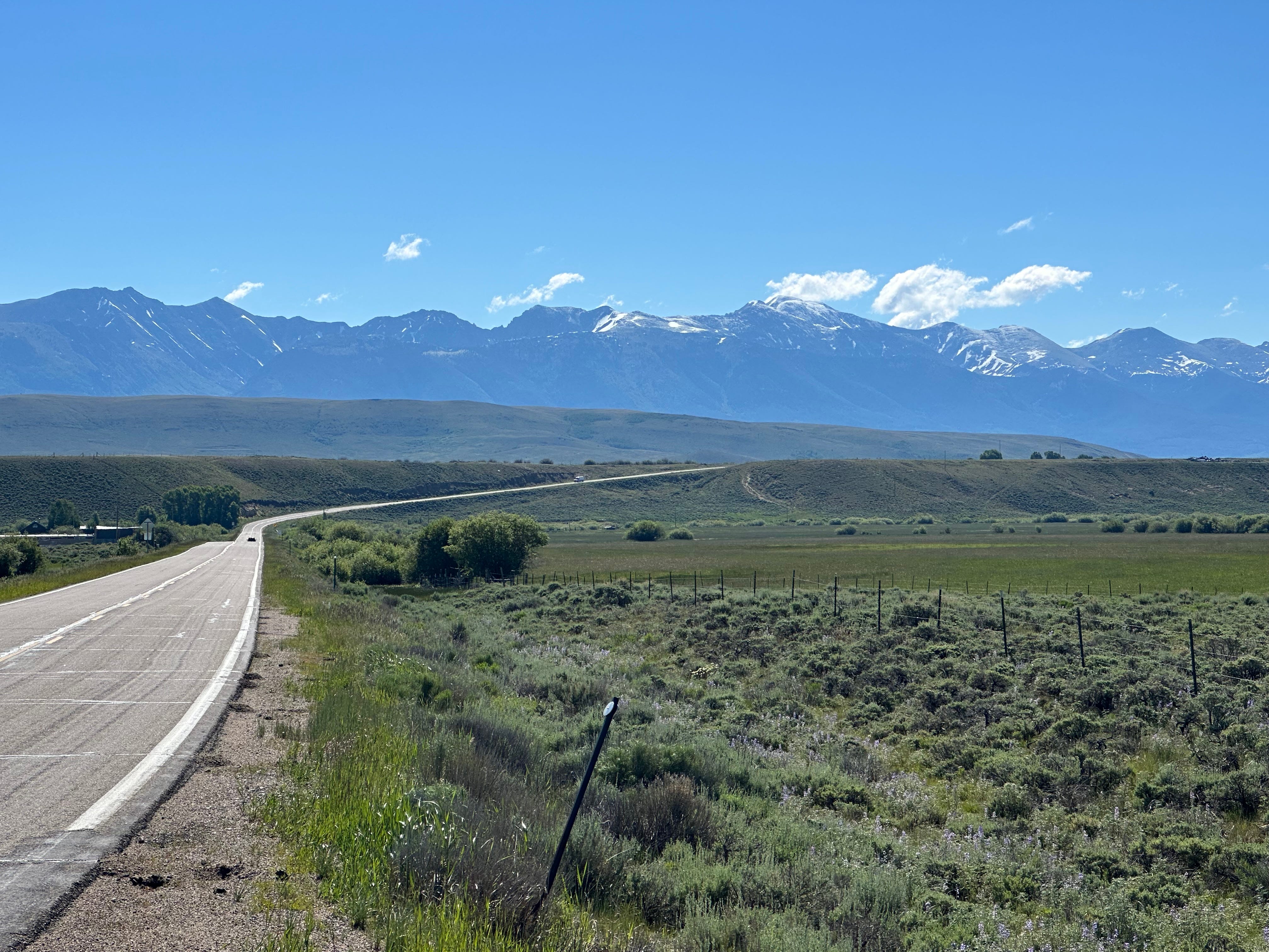
Entering Colorado seems like a breath of fresh air. It just feels cleaner and healthier. Unfortunately, in the land of reality, it isn’t. According to US News & World Reports, Colorado ranks number 44 in air quality in the US. Wyoming is actually a bit better, coming in at number 34. Our home State of Maine has the 2nd best. Of course, we are not really thinking about these things as we enter Colorado on the Trans-Am Bicycle Route. As I said, it feels like a breath of fresh air, and that is good enough for us.
We have never crossed the Rockies before; even 42 years ago, biking from North Carolina, we arrived in Colorado Springs and then biked down the spine of the Rockies to New Mexico, crossing the Continental Divide in New Mexico. So this will be our first true crossing.
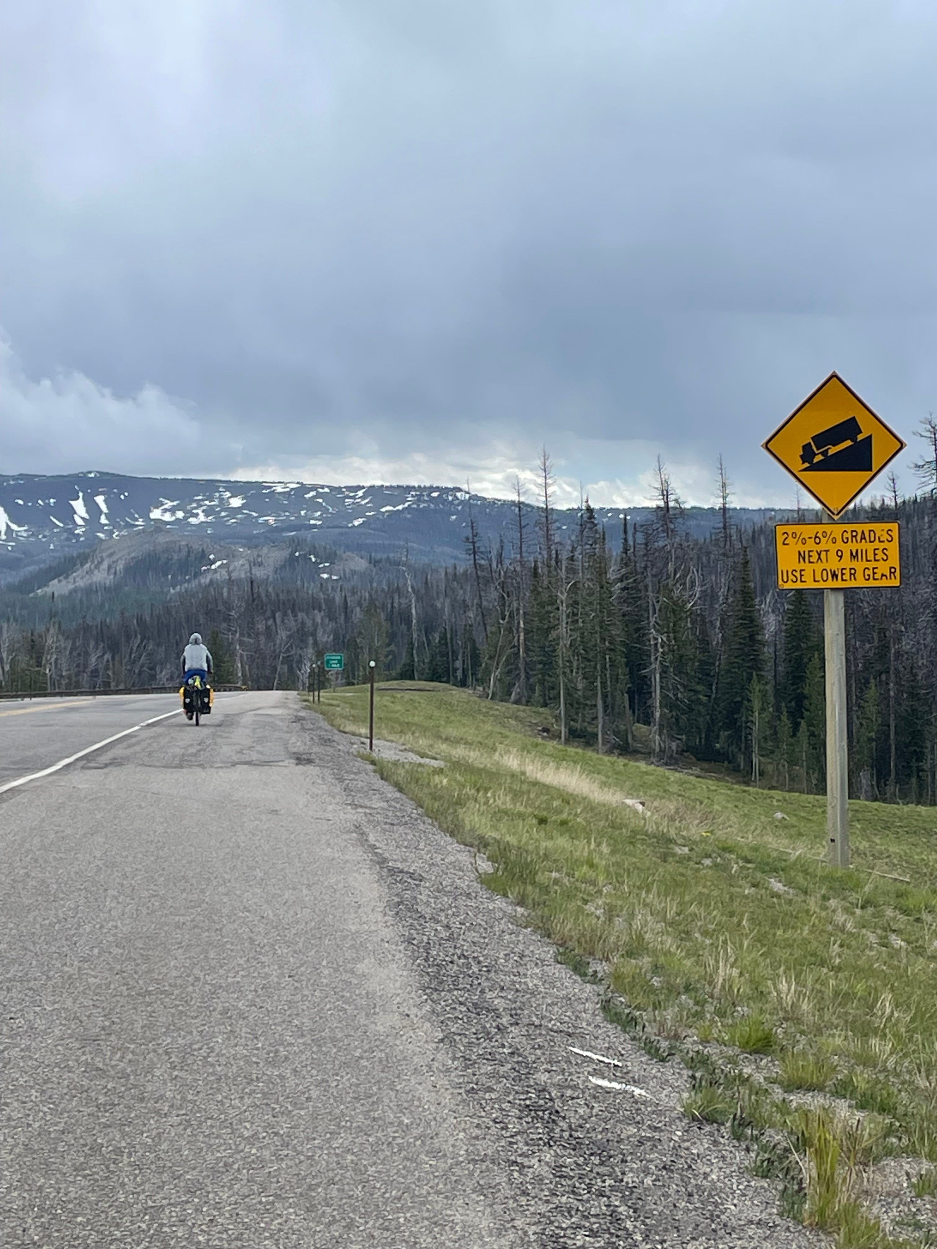
We will climb up and over Cameron Pass (elev. about 10,200 feet) and then descend into Fort Collins. First, however, is the ride from the Colorado border to Walden, Colorado, a small town that serves as a jumping off point to Cameron Pass. The ride is notable because the unbelievable Rockies become more prominent as we draw closer. We meet a young man from South Korea going in the opposite direction who began his journey a little over a month ago in Yorktown, Virginia, and has clung to the Trans-Am the entire way. He is very enthusiastic, and has had an amazing, very positive, adventure. Like our German friend in Yellowstone, he has been super-impressed with how friendly and helpful Americans have been.

We arrive in Walden, per our custom, late in the day. The town thoughtfully provides a large park within which it is permissible to camp. A storm is on the horizon, so we pitch our tent in a fairly sheltered area, surrounded by large bushes. The town also allows bikers to use a public recreation facility to shower, swim, lift weights, or use the sauna - all for $5.00. We do, gratefully, take showers.
The storm is mostly wind - upwards of 55 mph gusts. We retreat to our tent. I have been extra careful to secure it and just hope that it holds. The tent, remarkably, flattens against us as the wind seems to be building in intensity. Sheets of rain also fall. It is pretty scary, but we just sit tight to wait it out. I am glad we are within bushes, and not directly under trees, as branches have been crackling. The tent holds, and within a couple of hours, the weather is clear.
Cameron Pass and Fort Collins
We get up early to pack all of our disparate gear.
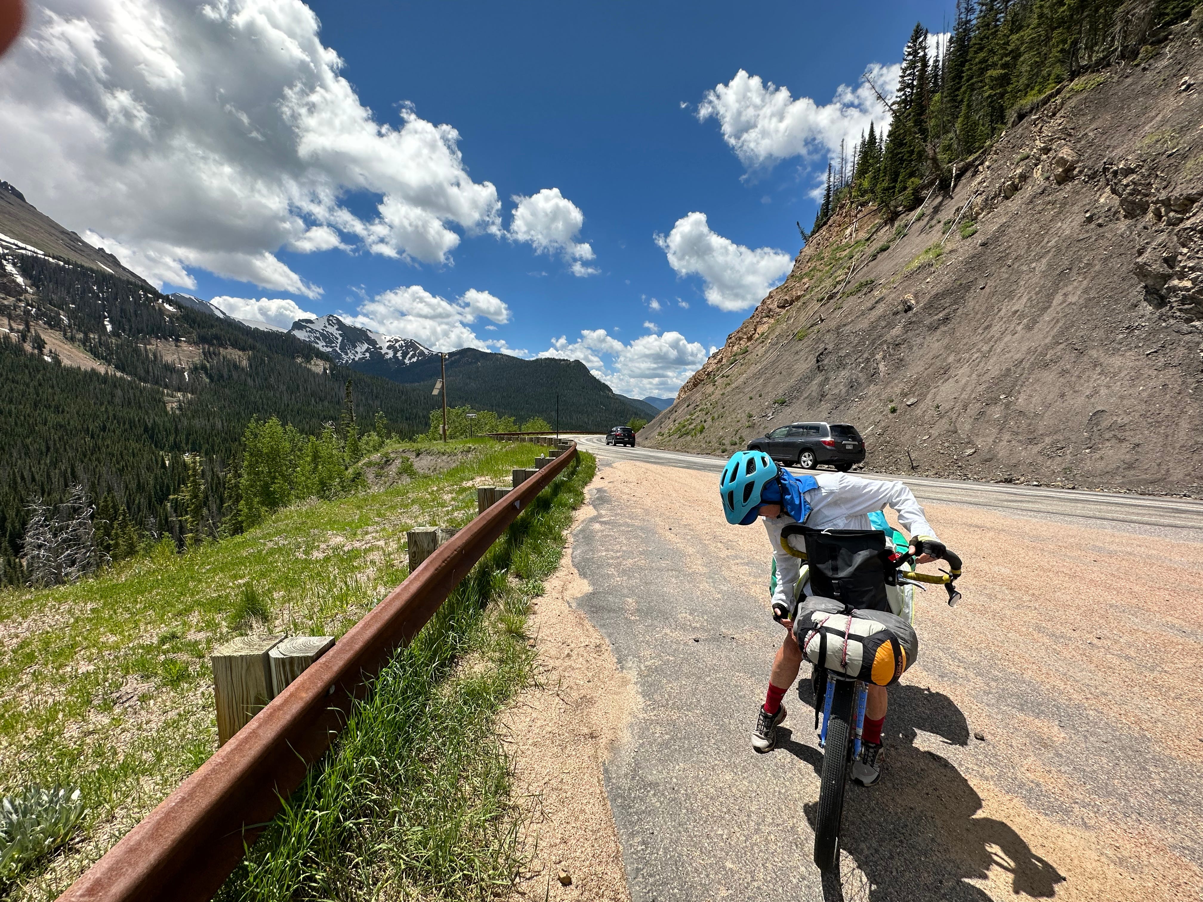
We wind through some switchbacks almost immediately from town. The climb is well-graded. Eating breakfast about 10 miles in, we are ready for the push to the top. It proves easier than we had thought it would be; one reason is that the actual climb from Walden (elevation: 8000 feet) to the pass is just 2200 feet. We are plodders, taking one pedal at a time. Our intent is to climb to the pass, and then camp at a National Forest campground, or maybe two, a little ways over the pass. From there, Fort Collins is on the agenda.
We encounter some young mountain bike riders who had been staying at various lodges and camping areas tucked into the mountains. This is a big mountain biking area, and we would see more recreational riders, many quite young, throughout the day. The presence of these riders marks a big change from the Wyoming side of the border, where we saw very few touring or mountain bicyclists. We are not really that far from the big population center of Fort Collins, which we understand to be quite bike friendly; hence all the recreational activity.
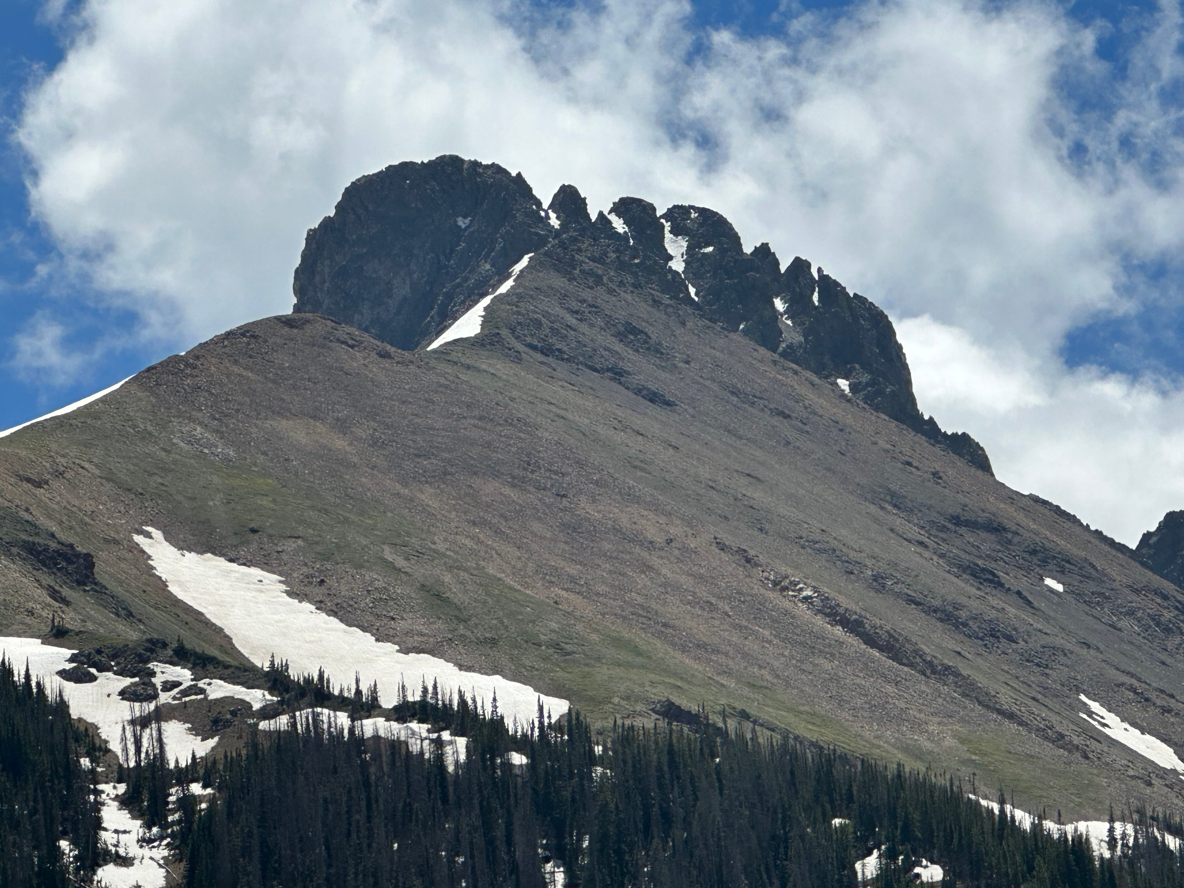
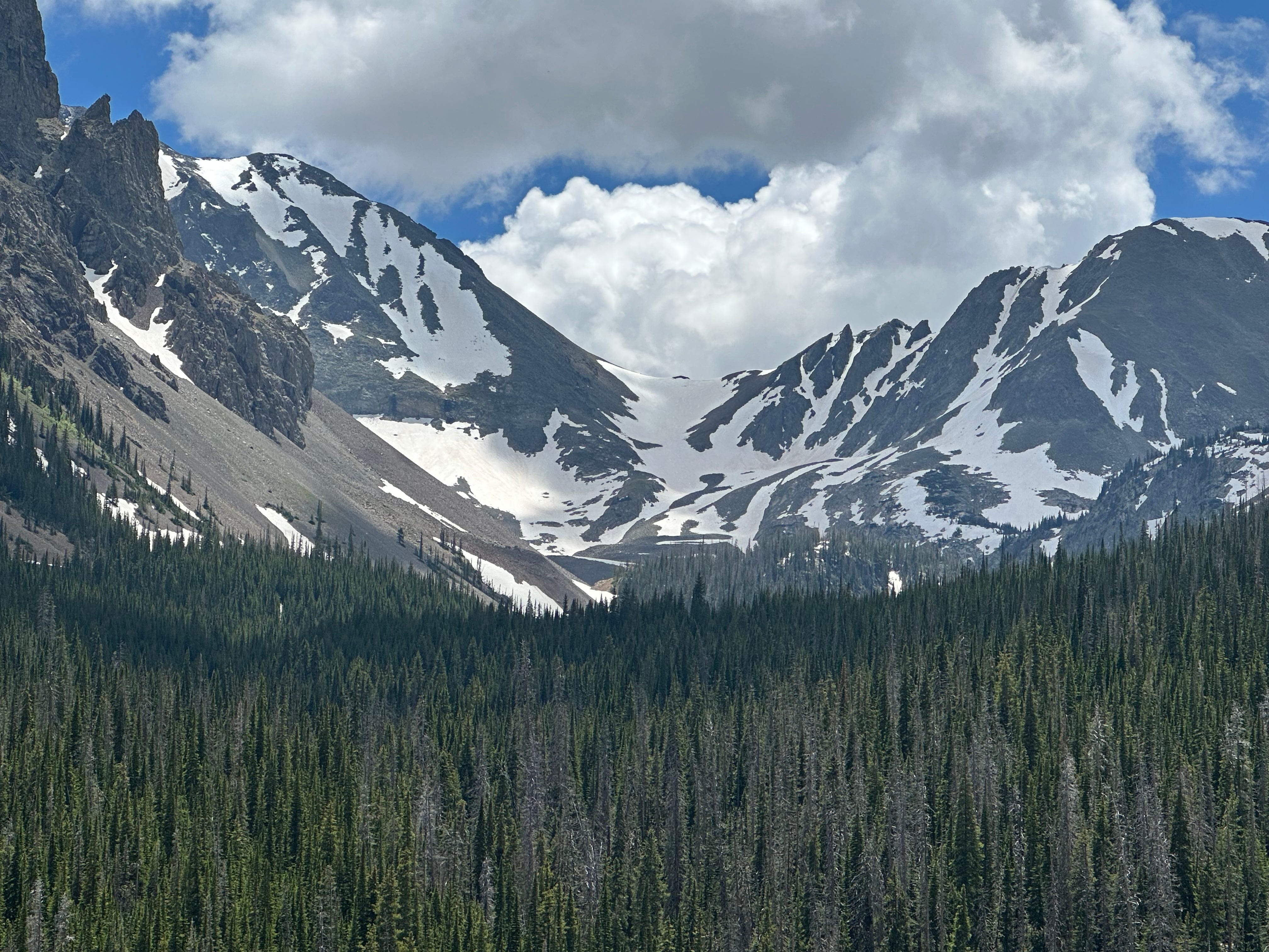
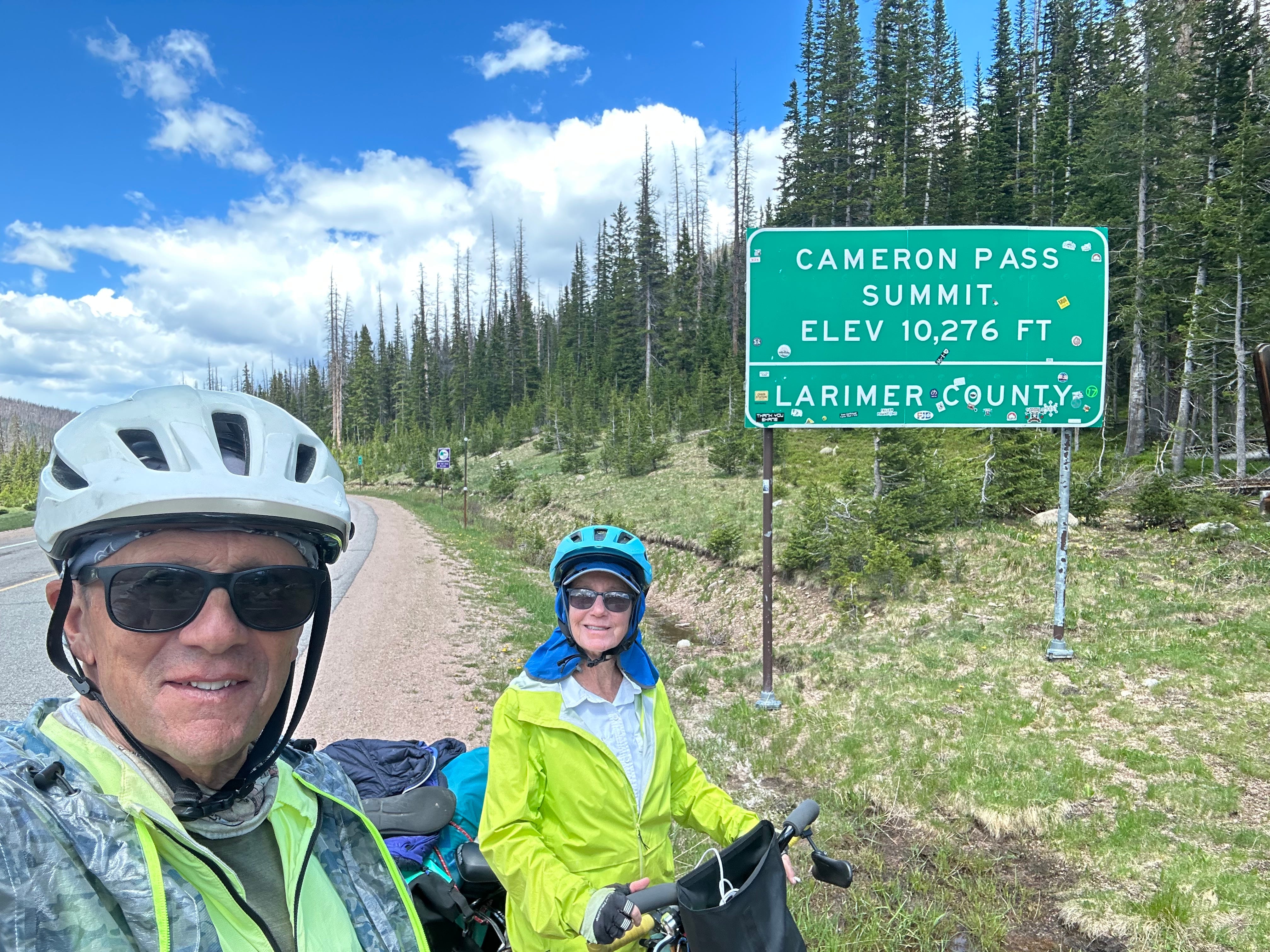
It is a bit anti-climactic reaching the pass. The sign is, typically, full of bullet holes. I’m not really sure why signs such as this one are so attractive to those with guns. In any event, the pass is also home to several small parking lots and hiking trails. We hang-out for a little while, and then start our descent, looking for good camping spots along the way.
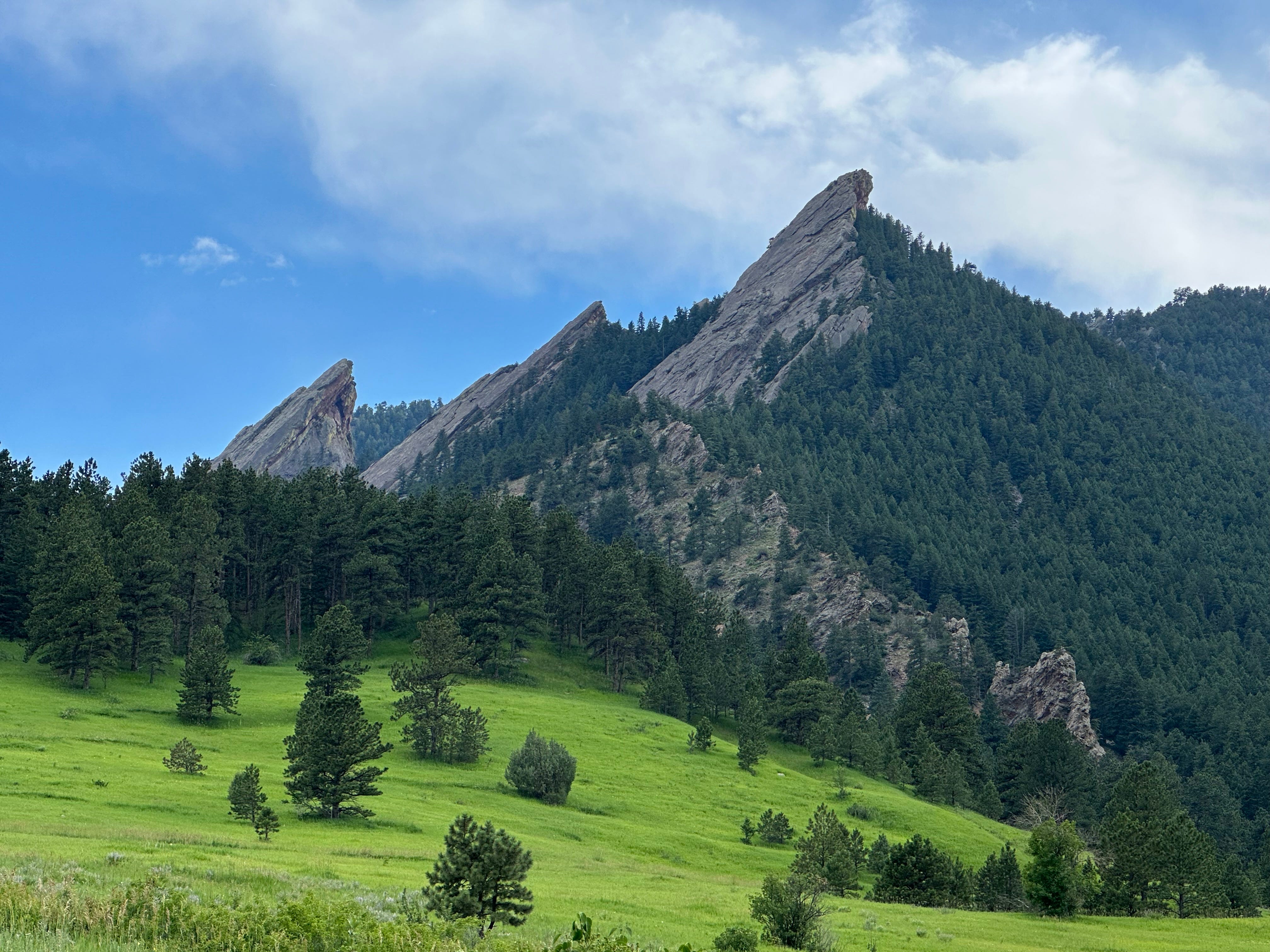
We ultimately do take two nights camping in the mountains along the Poudre River, which we follow all the way to Fort Collins. The area, particularly the descent, is perhaps the most beautiful we have encountered on the trip, which is saying something. It is obviously not as majestic or varied as Yellowstone, but in terms of concentrated beauty, it ranks very high. If you have never visited the area, we highly recommend it.
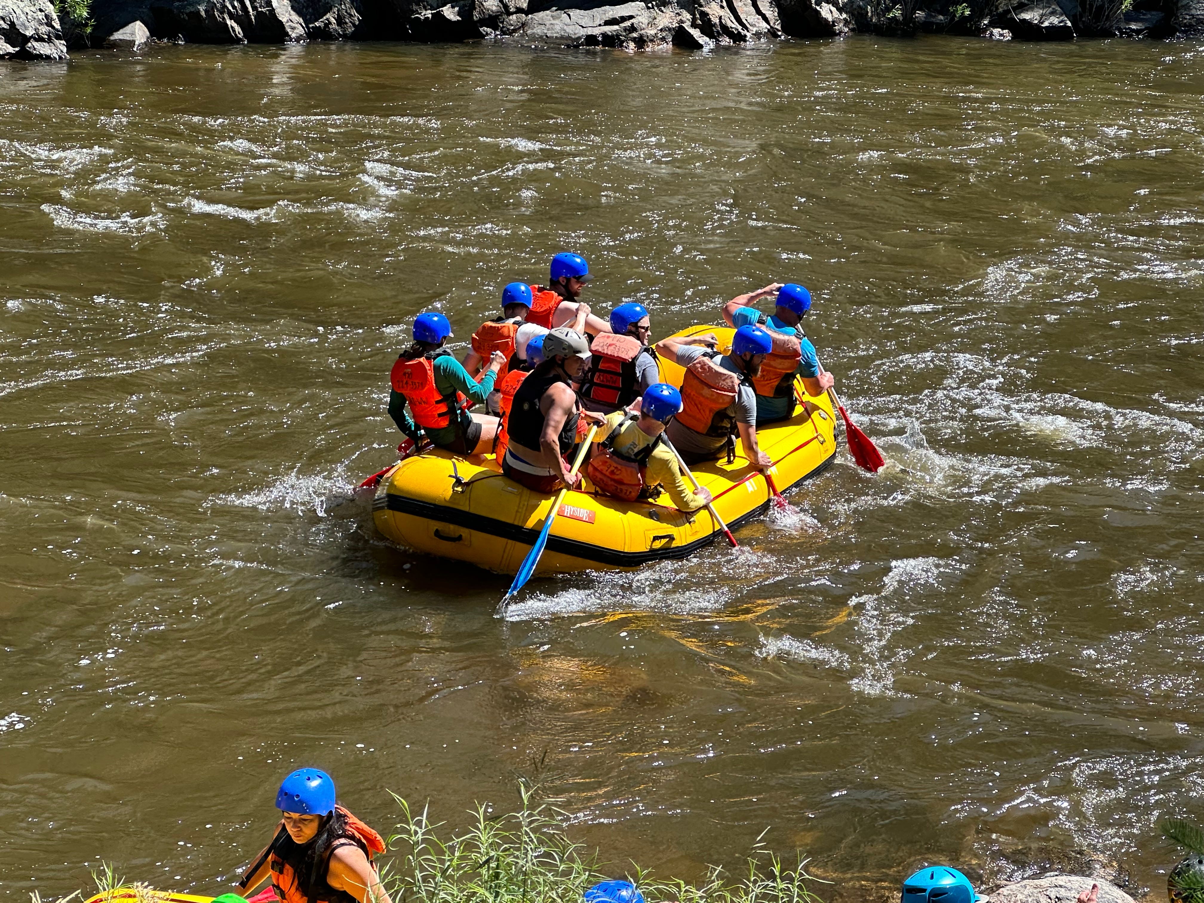
It is about 70 miles from Cameron Pass to Fort Collins, and the ride is mostly downhill. The uphill climb to the pass from Walden was, all told, about 30 miles, so we are going in the right direction, down into Colorado’s so-called Front Range. The river is roaring and we see that it is a big white water rafting zone, with large groups of people floating, recreating, and screaming down the rapids. The only down-side to our descent is the traffic, which picks up considerably the closer we get to the City. Drivers are generally courteous, but the road is steep in spots, twisty, and also full of trucks, so we must remain hyper-alert.
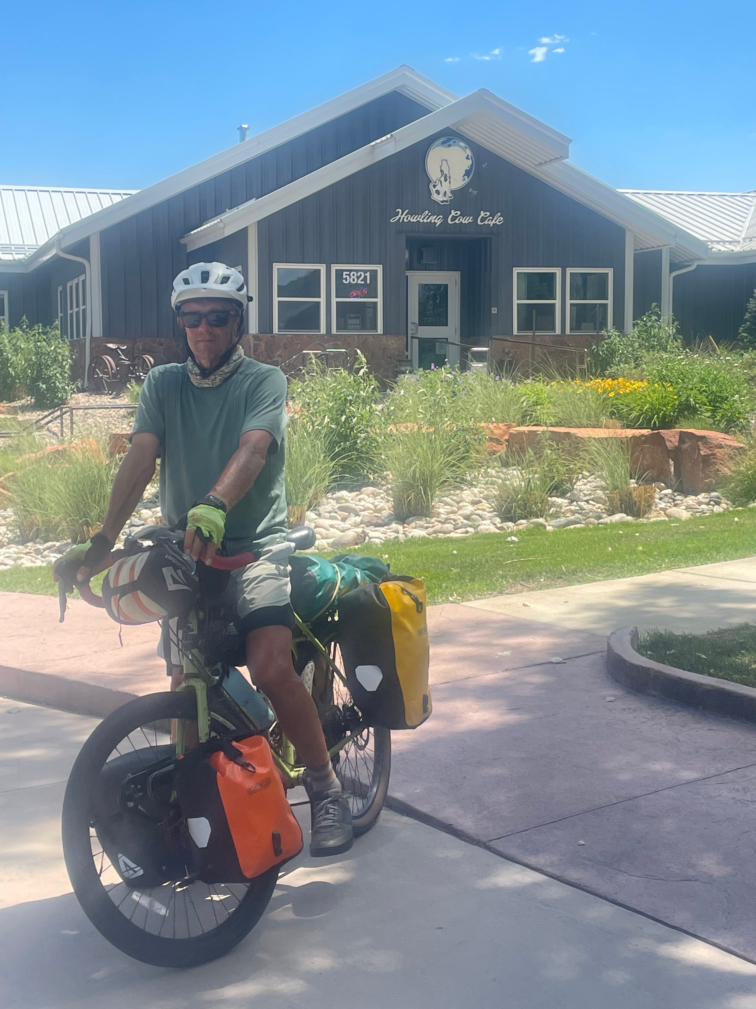
We always do our ice cream shop due diligence, and accordingly find the Howling Cow Cafe at the bottom of the mountain. With its special magnetic powers, it pulls us into its lovely parking lot. We see off to one side a number of cows grazing. This is a good sign. Another good sign is that it is crowded with bikers of all ages, some coming off a group ride up to the pass, and others just out for a quick trip to the ice cream shop.
I have lined up a Warmshowers host for the following night, but we are not sure where we will be sleeping tonight. We would rather not pay for an expensive hotel; our thoughts turn to the possibility of a stealth campsite somewhere on the outskirts of town. Standing in line for an ice cream cone, Pam strikes up a conversation with a couple of older (about our age) bikers who ask about our bikes and what we are up to. It turns out Paul and Mary are Warmshowers’ hosts, although they have temporarily taken themselves off the list for personal reasons. We ask about camping in the City, and it does not seem so easy; within about 30 seconds they have offered to open up their home to us for the night.
They are funny, kind, and knowledgable cyclists who have biked all over the country. Paul showed us their “bike room,” which is essentially a display area containing bikes, maps and various mementos of bike tours they have done in the past. They are also a font of information regarding the Front Range, Fort Collins cycling, and Colorado in general. We are grateful for their hospitality, and I place them among the two other mensches we have met on this trip (John of Tekoa, ID; Larry of Dillon, MT).
Fort Collins turns into a very pleasant surprise for us. Peopleforbikes.com ranks the City 223 out of 1733 total rankings, an 87th percentile score. The City, with a population of just 170,000, has a dedicated department, FC Moves, “that exists to advance mobility solutions to increase walking, bicycling, transit use, shared, and environmentally sustainable modes [of transportation].” With well over 250 miles of trails, many dedicated (200 miles), within Fort Collins, getting around off-road is quite doable, and we very much enjoy the riding while we are there. Fort Collins is also home to Colorado State University, which has a large, but not overwhelming, impact on the City. Our second night in town is spent with two former faculty member from CSU who are now Warmshowers’ hosts.
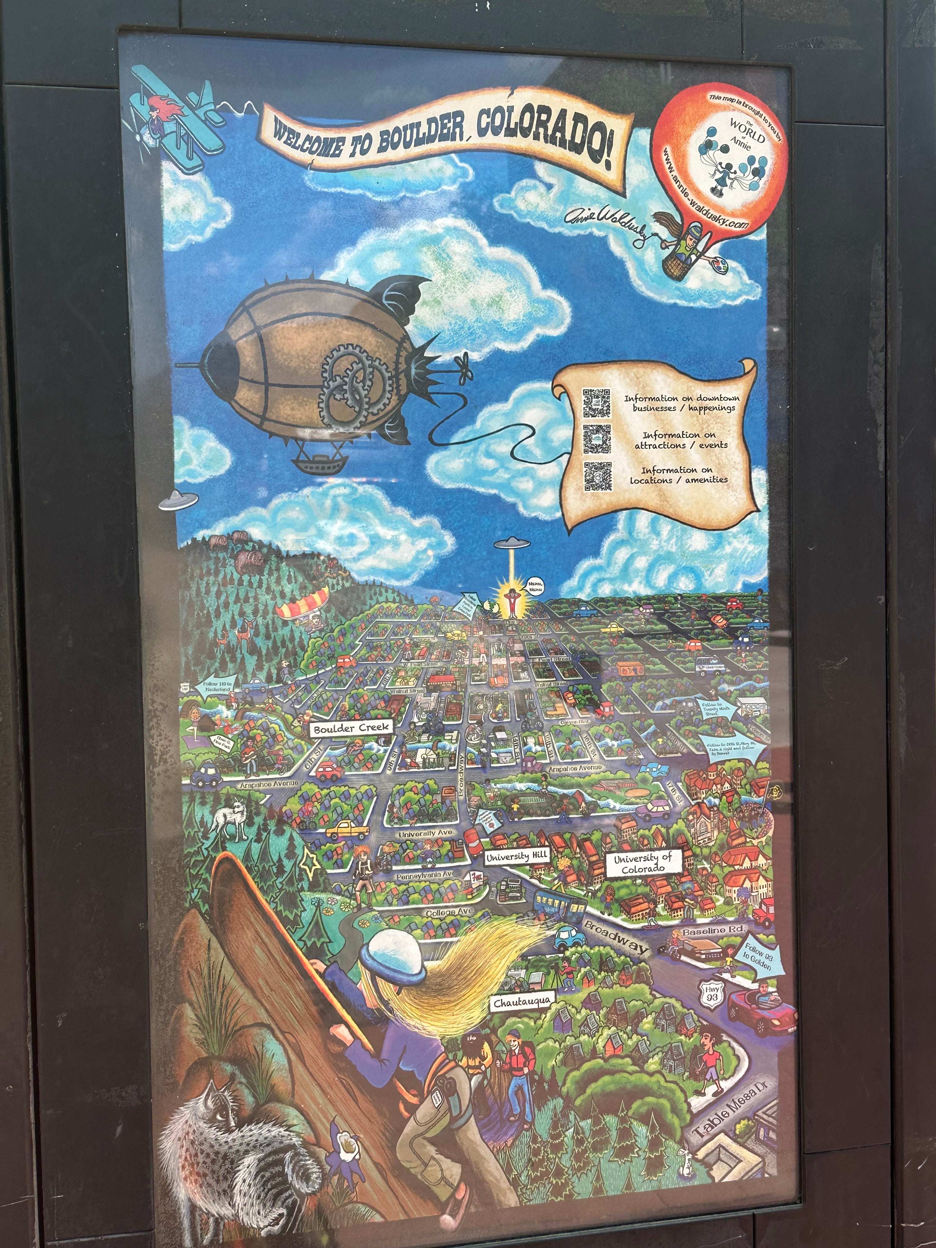
Boulder
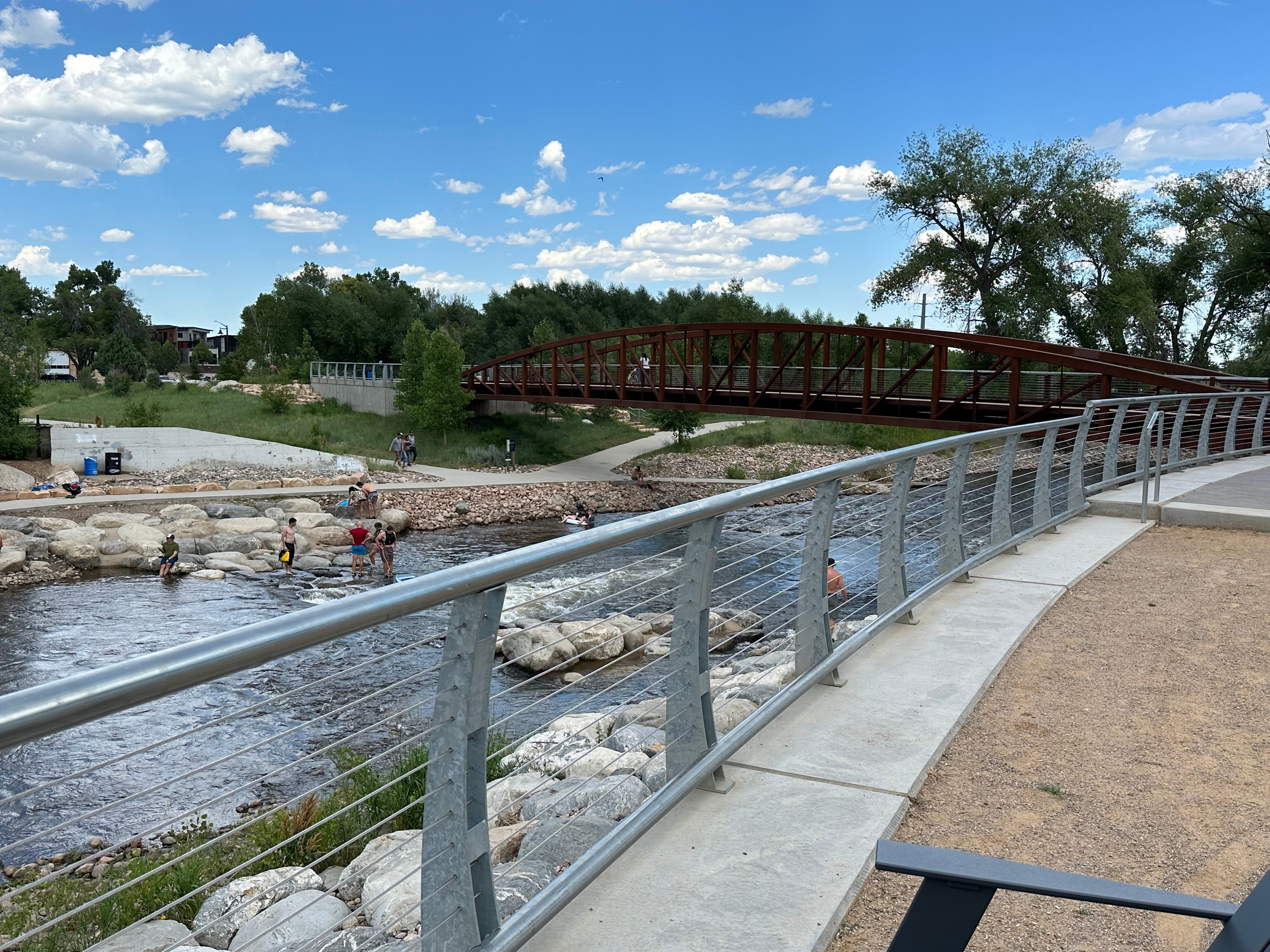
The ride from Fort Collins to Boulder, just 50 miles, can be done almost entirely on dedicated bike lanes, mostly protected. I later learn that we are essentially riding part of the Front Range Trail, a concept-in-active-development that will hopefully connect Wyoming to New Mexico. According to Larimer County, Colorado, “The vision is to create a multi-use trail from Wyoming to New Mexico along the Front Range of Colorado. This more than 800 mile trail will link diverse communities, scenic landscapes, cultural and historic points, parks, open spaces and other attractions.” We can attest that they are well on their way, and far ahead of any other region we have biked in within the US as far as biking infrastructure is concerned.
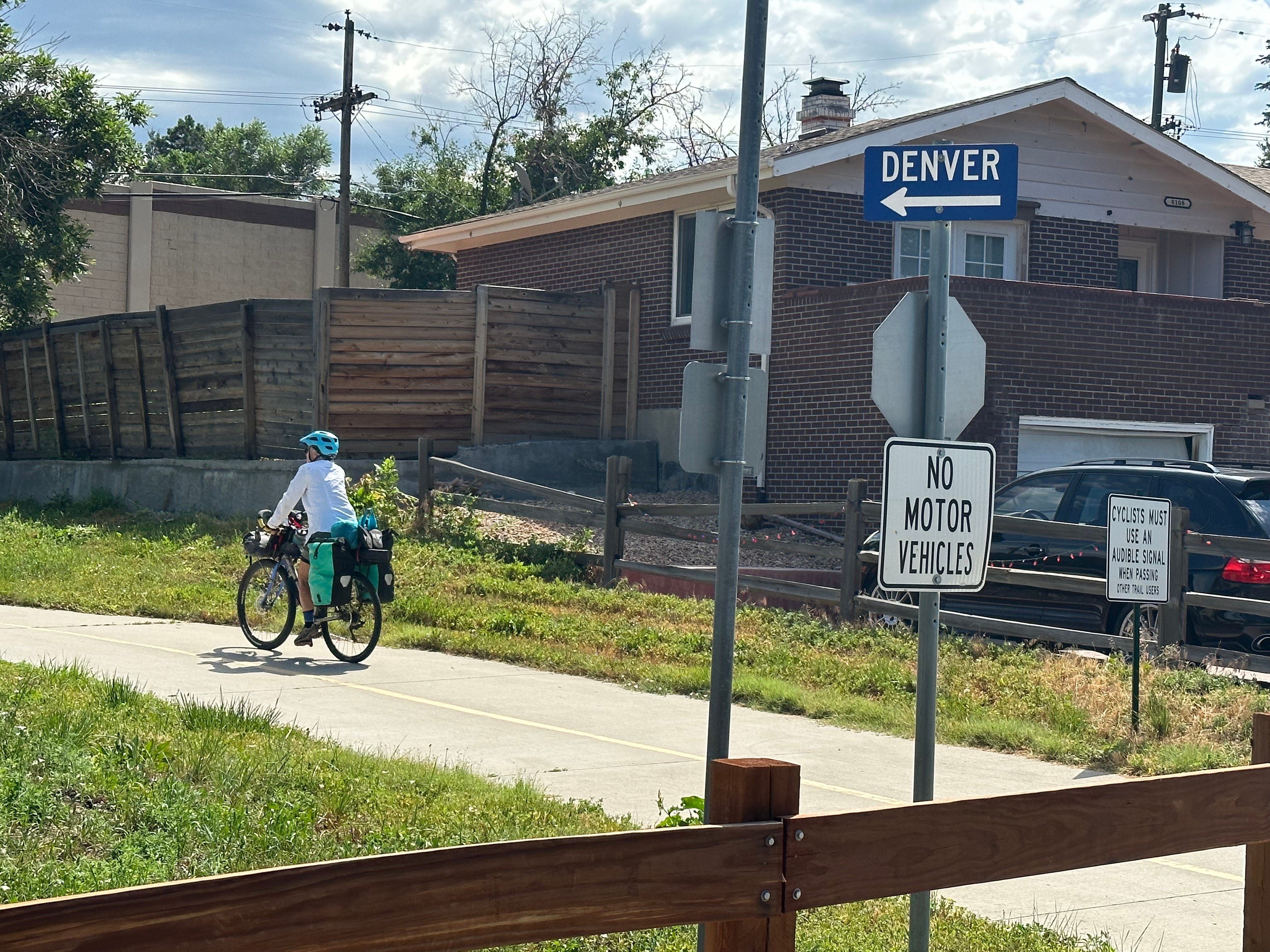
We actually break the ride into two pieces, camping in Lyons, Colorado the first night. Lyons, in Boulder County, is just 20 miles from Rocky Mountain National Park, and we are tempted to ride there. But time is growing short (yes, time does grow short for us). Our intent is to bike to Denver and fly home to Maine towards the end of July 2023.
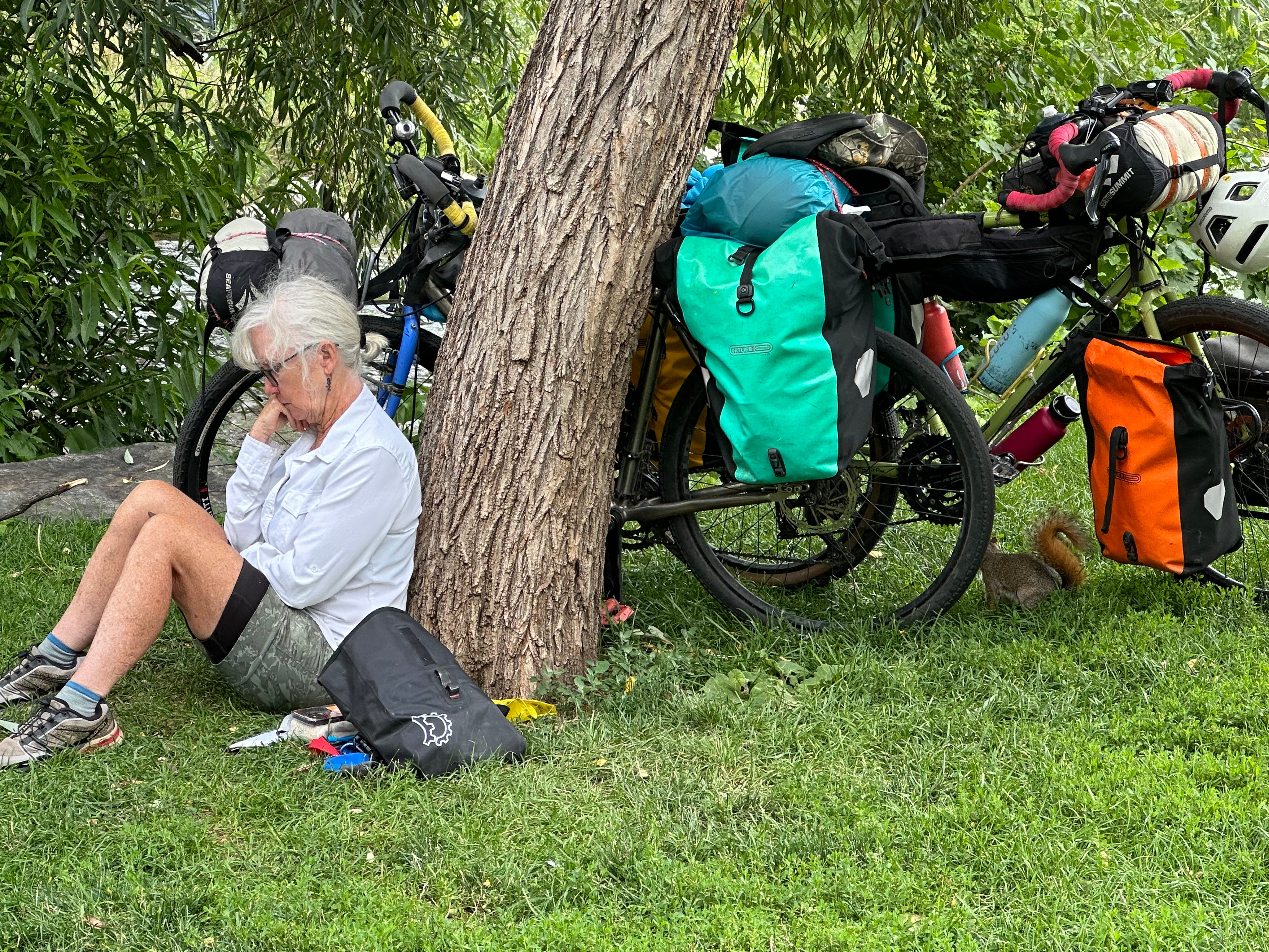
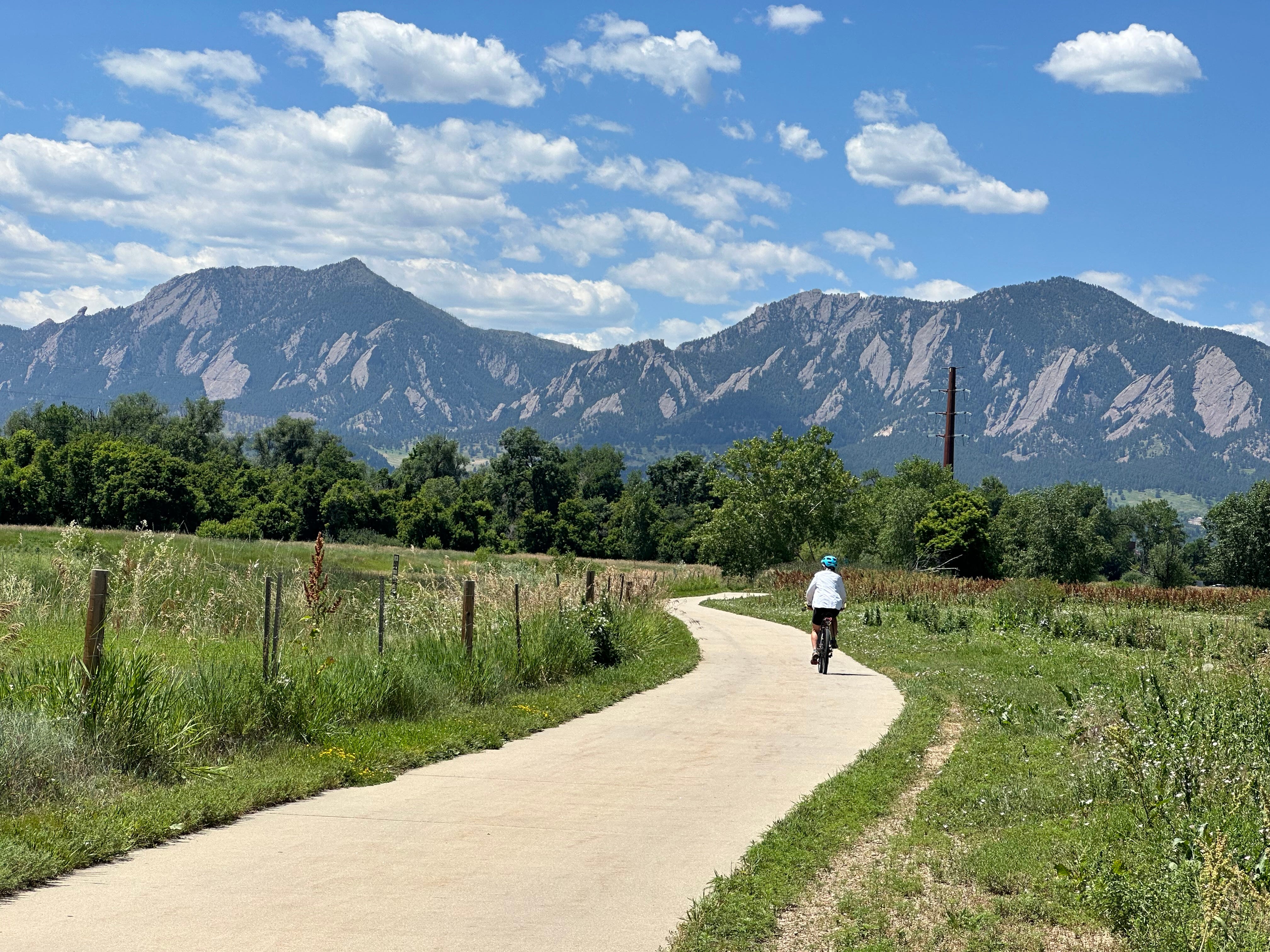
Peopleforbikes.com, based in Boulder (pop. 108,000), ranks Boulder (a mid-size city) in the 97th percentile of all cities in the US. I am frankly surprised it is not number one. As soon as we enter Boulder and start exploring, we are taken aback by the highly-developed infrastructure, bike friendly road system, and community emphasis on biking. The greater Boulder Valley contains more than 300 miles of bikeways, including 96 miles of bike lanes, 84 miles of multi-use paths, and 50 miles of designated bike routes. Due to its relatively small size, we are able to get a handle on the contours of the City fairly easily, and decide to spend a week there as a gift to ourselves.
Pam has been to Boulder before, in 1978, as part of her Solar Roller adventure. That experience will be the subject of a future post.
The End
After a week of R & R in Boulder, we bike the final 30 miles to Denver. We visit friends, tour around Denver for a week or so, and then fly home, ending an almost one-year absence from home. After recuperating from a fractured wrist (falling off her bike a mile from our house, of course) in the fall of 2022, we flew to Merida, Mexico, ultimately biking from Merida to Mexico City, north to Guanajuato, and then west to Guadalajara. We flew back to the US in the spring of 2023, taking trains to Washington State, in preparation for a cross-country ride back to Maine. Instead, we shortened things up, riding from Seattle to Denver.
I always have mixed feelings when ending a lengthy bike trip. Change is always hard, whether one is changing from the rhythms of bike travel to the comforts of home, or vice-versa. Each has its benefits and challenges. We are glad to be going home, seeing family and friends, and re-integrating into our community. Having a home to go back to and enjoy is, in my view, critical to the success of our bike trips.
We do have unfinished business in Mexico. We had intended to bike from Merida to at least Guatamala City, but wimped out due to the intense heat, consequently missing Oaxaca and Chiapas States in southern Mexico. We had especially wanted to get to Oaxaca as we had traveled there 42 years ago, and wanted another look. Biking to Oaxaca is not easy (many mountains, difficult terrain), so we decided it merited its own trip. We took the plunge in January 2024, doing a mostly off-road bikepacking trip from Mexico City to Puerto Escondido, via Oaxaca. That trip will be the subject of my next several posts.
NEXT TIME: Bikepacking from Mexico City to Puerto Escondido, via Puebla, Tehuacan, and Oaxaca City.
Great piece! i thoroughly enjoyed reading it. Got a good laugh about the "big macs protruding from their mouths" comment.
Love the little guy at the end (marmot?)